Area Overview for CW12 2AX
Photos of CW12 2AX
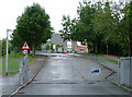
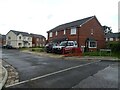
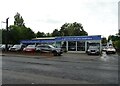
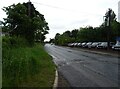
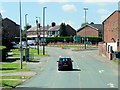
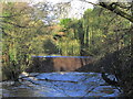
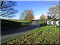
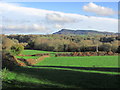
11 photos from this area
Area Information
Key information about the CW12 2AX including its size, population, and administrative classification.
- Area Type
- Postcode
- Area Size
- 3.6 hectares
- Population
- 1455
- Population Density
- 4011 people/km²
House Prices in CW12 2AX
61
Properties
£116,685
Average Sold Price
£30,000
Lowest Price
£223,500
Highest Price
Showing 61 properties
| Address | Type | Beds | Baths | Last Sale Price | Last Sale Date | |
|---|---|---|---|---|---|---|
| 89 St Johns Road, Congleton, CW12 2AX | Semi-detached | 3 | 1 | £223,500 | Dec 2025 | |
| 55 St Johns Road, Congleton, CW12 2AX | Terraced | 3 | 1 | £195,000 | Dec 2024 | |
| 102 St Johns Road, Congleton, CW12 2AX | Semi-detached | 3 | 1 | £150,000 | Sep 2022 | |
| 76 St Johns Road, Congleton, CW12 2AX | house | - | - | £135,000 | Mar 2022 | |
| 106 St Johns Road, Congleton, CW12 2AX | Semi-detached | 2 | 1 | £167,500 | Jul 2021 | |
| 97 St Johns Road, Congleton, CW12 2AX | house | 3 | - | £160,000 | Aug 2020 | |
| 83 St Johns Road, Congleton, CW12 2AX | Semi-detached | 3 | 1 | £138,000 | Jan 2019 | |
| 91 St Johns Road, Congleton, CW12 2AX | Semi-detached | 3 | 1 | £145,000 | Sep 2018 | |
| 61 St Johns Road, Congleton, CW12 2AX | Terraced | 3 | 1 | £110,000 | Mar 2016 | |
| 99 St Johns Road, Congleton, CW12 2AX | house | - | - | £116,500 | Jan 2016 |
Page 1 of 7
Energy Efficiency in CW12 2AX
Amenities
Schools
| Rank | School | Type | Entry gender | Ages |
|---|
Explore more schools in this area
Go to Schools tabDemographics
Household Size
Two person
most common
Accommodation Type
Houses
most common
Tenure
65
majority
Ethnic Group
White
most common
Religion
N/A
most common
Household Composition
N/A
most common
Age
47
median
Adults (30-64 years)
most common
Household Deprivation
N/A
with no deprivation
NS-SEC
33
in Lower managerial occupations
Explore more demographic insights in this area
Go to Demographics tabPlanning
Planning Constraints
- Flood RiskPremium
- Ramsar Wetland SitesPremium
- Area of Outstanding Natural BeautyPremium
- Protected Nature ReservePremium
- Protected WoodlandPremium