Area Overview for CW12 1YT
Photos of CW12 1YT


Area Information
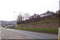
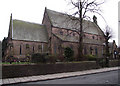
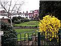
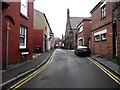
CW12 1YT is a small residential postcode area nestled in Cheshire, part of the historic market town of Congleton. With a population of 1,872, it reflects the character of a close-knit community, where the median age of 47 suggests a stable demographic skewed toward adults aged 30–64. This area sits at the edge of the Cheshire Plain, near the river Dane, a location that has shaped Congleton’s development since Neolithic times. Daily life here is defined by proximity to Congleton’s heritage, including its 19th-century park and historic railway station. The area’s compact size means residents enjoy a balance of rural tranquillity and access to local amenities. Congleton itself, with its medieval roots and 13th-century market charter, offers a blend of tradition and modern convenience. The postcode’s small footprint ensures a sense of familiarity, though its limited size may mean buyers should consider nearby neighbourhoods for broader options. For those seeking a quiet, family-oriented setting with historical depth, CW12 1YT provides a snapshot of Cheshire’s enduring charm.
- Area Type
- Postcode
- Area Size
- Not available
- Population
- 1872
- Population Density
- 2722 people/km²
The property market in CW12 1YT is dominated by owner-occupied homes, with 51% of properties owned by residents rather than rented. The accommodation type is exclusively houses, indicating a lack of high-rise or apartment blocks. This suggests a market tailored to families seeking traditional homes, though the small size of the postcode may limit availability. Buyers should consider the surrounding areas for more options, as the immediate vicinity may have limited stock. The focus on houses aligns with the area’s historical development as a market town, where residential properties are likely to be older and characterful. For those prioritising property value stability, the lower home ownership rate could signal opportunities, though competition may be fierce in such a compact postcode.
House Prices in CW12 1YT
No properties found in this postcode.
Energy Efficiency in CW12 1YT
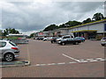
The lifestyle in CW12 1YT is shaped by its proximity to retail and rail amenities. Nearby shops include Tesco Congleton, M&S Congleton SF, and Farmfoods Congleton, offering everyday essentials and convenience. The rail network, with stations at Congleton, Kidsgrove, and Goostrey, provides access to regional travel, though specifics on journey times are not available. While the data does not list parks or leisure facilities directly, Congleton Park—a notable landmark mentioned in local research—offers recreational space nearby. The combination of retail options and rail connectivity supports a practical, community-focused lifestyle, ideal for those valuing accessibility without sacrificing the area’s small-town character.
Amenities
Schools
The nearest school to CW12 1YT is Saint Mary’s Catholic Primary School, which serves the area with primary education. The school holds an Ofsted rating of ‘satisfactory’, reflecting its adequacy in meeting educational standards. While no secondary schools are listed in the data, the presence of a primary school suggests families have access to foundational education. The single school option may limit choices for parents seeking alternative curricula or higher educational provisions. However, the satisfactory rating indicates a baseline level of quality, though further research into additional schools or private options may be necessary for comprehensive planning.
| Rank | School | Type | Entry gender | Ages |
|---|
Explore more schools in this area
Go to Schools tabDemographics
The community in CW12 1YT is predominantly composed of adults aged 30–64, with a median age of 47. Home ownership stands at 51%, indicating a mix of owner-occupied properties and rental units. The area is characterised by houses rather than flats, reflecting a preference for traditional family homes. The predominant ethnic group is White, though no specific data on diversity or deprivation levels is provided. The population size of 1,872 suggests a modest, tightly knit neighbourhood where social networks are likely strong. For buyers, the age profile implies a stable housing market with demand from middle-aged professionals and families. The absence of detailed diversity statistics means the community’s social fabric remains partially opaque, but the demographic stability offers reassurance for long-term residency.
Household Size
Accommodation Type
Tenure
Ethnic Group
Religion
Household Composition
Age
Household Deprivation
NS-SEC
Explore more demographic insights in this area
Go to Demographics tabPlanning
Planning Constraints
- Flood RiskPremium
- Ramsar Wetland SitesPremium
- Area of Outstanding Natural BeautyPremium
- Protected Nature ReservePremium
- Protected WoodlandPremium