Area Overview for CW12 1YA
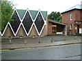
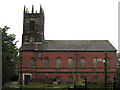
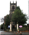
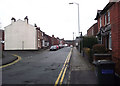
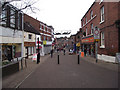
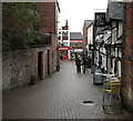
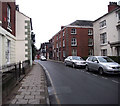
Photos of CW12 1YA


Area Information
Living in CW12 1YA means being part of a small, tightly knit residential cluster within Congleton, a historic market town in Cheshire. With a population of 1,446, the area reflects a mature community, where the median age is 47 and most residents fall within the 30-64 age range. This is a place where families and established locals coexist, with homes predominantly in private ownership. The postcode sits in a town with roots stretching back to the Domesday Book, yet it balances heritage with modern convenience. Residents benefit from proximity to Congleton’s amenities, including its railway stations and retail hubs. The area’s compact size means daily life is walkable, with easy access to green spaces like Congleton Park and the river Dane. Digital connectivity is exceptional, with a broadband score of 99 and mobile coverage rated 83. While the town’s industrial past is evident in its historic mills, today’s CW12 1YA offers a quiet, low-crime environment ideal for those seeking stability and a connection to local history.
- Area Type
- Postcode
- Area Size
- Not available
- Population
- 1446
- Population Density
- 3454 people/km²
The property market in CW12 1YA is characterised by a strong presence of owner-occupied homes, with 54% of properties in private hands. The accommodation type is predominantly houses, which suggests a focus on family-friendly, larger homes rather than flats or apartments. This aligns with the area’s demographic profile of adults aged 30-64, likely including families. Given the small size of the postcode area, the housing stock is limited, and buyers should consider the immediate surroundings for additional options. The market may cater more to those seeking established homes than to first-time buyers or renters, though the data does not specify rental availability. The concentration of houses also implies a quieter, more suburban character, which may appeal to those prioritising space and community over urban density.
House Prices in CW12 1YA
No properties found in this postcode.
Energy Efficiency in CW12 1YA
Daily life in CW12 1YA is enriched by nearby amenities, including five retail outlets such as Morrisons Congleton, Tesco Congleton, and M&S Congleton. These provide convenience for shopping, dining, and everyday needs. The area’s proximity to Congleton Railway Station and other nearby stations ensures easy access to public transport, supporting both leisure and commuting. Green spaces like Congleton Park, opened in 1871, offer recreational opportunities, from walks to family activities. The town’s historic character, including its 13th-century market rights and industrial heritage, adds cultural depth. While the data does not specify restaurants or cafes, the presence of major retailers and rail links suggests a practical, community-focused lifestyle with a balance of heritage and modern amenities.
Amenities
Schools
Nearby schools in CW12 1YA include Marlfields Primary School, which has an Ofsted rating of satisfactory, and Congleton St James CofE Primary School, though its rating is not specified. Aidenswood School, a special school with a good Ofsted rating, provides specialist education for students with specific needs. The presence of both primary and special schools suggests a diverse educational landscape, catering to a range of family requirements. For parents, this mix ensures access to mainstream education and support for children with additional needs. However, the data does not indicate secondary schools or further education options in the immediate vicinity, so families may need to look beyond the postcode for comprehensive schooling.
| Rank | School | Type | Entry gender | Ages |
|---|
Explore more schools in this area
Go to Schools tabDemographics
The community in CW12 1YA is predominantly composed of adults aged 30-64, with a median age of 47. This suggests a population of working-age individuals and families, many of whom are likely to be homeowners. Home ownership stands at 54%, indicating a mix of owner-occupied properties and rental homes, though the data does not specify the latter’s proportion. The area’s accommodation is largely houses, which aligns with the demographic profile of established households. The predominant ethnic group is White, though the data does not provide further breakdowns. The low median age and high home ownership rate suggest a community focused on long-term stability, with limited evidence of transient populations. For quality of life, this balance of mature residents and family homes may foster a cohesive, low-traffic environment.
Household Size
Accommodation Type
Tenure
Ethnic Group
Religion
Household Composition
Age
Household Deprivation
NS-SEC
Explore more demographic insights in this area
Go to Demographics tabPlanning
Planning Constraints
- Flood RiskPremium
- Ramsar Wetland SitesPremium
- Area of Outstanding Natural BeautyPremium
- Protected Nature ReservePremium
- Protected WoodlandPremium