Area Overview for CW12 1XB
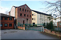
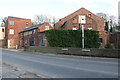
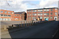
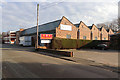
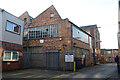
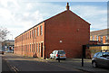
Photos of CW12 1XB


Area Information
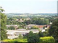
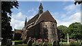
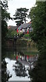
CW12 1XB is a small, tightly knit postcode area in England, encompassing a residential cluster within the Cheshire Plain. With a population of 1,872, it reflects the character of a traditional market town, rooted in history yet connected to modern amenities. The area lies near Congleton, a civil parish with a heritage stretching back to the Domesday Book, where it was noted as a settlement with land for four ploughs. Today, CW12 1XB sits at the edge of the Peak District, offering a blend of rural tranquillity and accessible services. Residents benefit from proximity to Congleton’s historic core, including its Saturday market and railway station, which opened in 1848. The area’s compact size means a strong sense of community, with homes predominantly in houses rather than flats, catering to families and individuals seeking stability. While the population is relatively small, the area’s infrastructure—such as nearby schools and retail hubs—supports daily life. Living here involves a balance of historical charm and practical modernity, with low crime rates and minimal environmental risks enhancing its appeal.
- Area Type
- Postcode
- Area Size
- Not available
- Population
- 1872
- Population Density
- 2722 people/km²
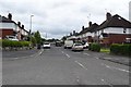
The property market in CW12 1XB is defined by its small scale and focus on owner-occupied homes. With 51% of properties owned by residents, the area leans toward a modestly stable market rather than a high-turnover rental sector. The accommodation type is predominantly houses, which suggests a preference for single-family dwellings over flats or apartments. This aligns with the area’s traditional market town character, where housing stock reflects historical development patterns. For buyers, this means a limited selection of properties, all likely to be detached or semi-detached homes. The small population and compact footprint of CW12 1XB mean that property values are unlikely to be influenced by speculative demand, instead reflecting local demand from families and long-term residents. Buyers should consider the area’s constraints—its size and proximity to Congleton’s amenities—as factors shaping both availability and price.
House Prices in CW12 1XB
No properties found in this postcode.
Energy Efficiency in CW12 1XB
Daily life in CW12 1XB is shaped by its proximity to Congleton’s amenities, including five retail outlets such as Morrisons Congleton, Co-op Bromley, and Tesco Congleton. These shops provide access to groceries, household goods, and other essentials, reducing the need for long trips. The area’s railway stations—Congleton, Kidsgrove, and Alsager—offer connections to nearby towns and cities, though journey times are not specified. Locally, Congleton Park is a notable feature, offering recreational space for residents. The park’s history, including its 1871 opening, adds to its appeal as a community hub. While the data does not list restaurants or leisure facilities, the presence of a market town nearby suggests a range of dining and cultural options. The combination of retail convenience, green space, and transport links creates a lifestyle that balances practicality with the charm of a small town.
Amenities
Schools
The nearest school to CW12 1XB is Saint Mary’s Catholic Primary School, which serves the area’s primary education needs. The school is listed twice in the data, both times noting its primary category and an Ofsted rating of satisfactory. This indicates a single institution providing education for younger children, though no secondary schools are mentioned in the data. The presence of a primary school suggests that families with young children may find the area suitable, though parents seeking secondary education would need to look beyond the immediate vicinity. The satisfactory Ofsted rating implies that the school meets basic standards but may not excel in specialist areas such as STEM or arts. For families prioritising school quality, further research into broader educational options in Congleton would be necessary.
| Rank | School | Type | Entry gender | Ages |
|---|
Explore more schools in this area
Go to Schools tabDemographics
The median age in CW12 1XB is 47, with the majority of residents falling within the 30–64 age range. This suggests a community skewed toward middle-aged adults, likely including families and professionals. Home ownership stands at 51%, indicating a modest mix of owner-occupied and rental properties, though the data does not specify rental rates. The predominant accommodation type is houses, which aligns with the area’s residential character and suggests a focus on family-friendly living. The predominant ethnic group is White, with no further breakdown provided. While the data does not include deprivation metrics, the low crime score of 77 (a Pass rating) and absence of environmental constraints imply a stable, low-risk environment. This demographic profile reflects a mature, settled population with access to essential services, though the area’s small size means limited diversity in household composition or cultural representation.
Household Size
Accommodation Type
Tenure
Ethnic Group
Religion
Household Composition
Age
Household Deprivation
NS-SEC
Explore more demographic insights in this area
Go to Demographics tabPlanning
Planning Constraints
- Flood RiskPremium
- Ramsar Wetland SitesPremium
- Area of Outstanding Natural BeautyPremium
- Protected Nature ReservePremium
- Protected WoodlandPremium