Area Overview for CW12 1TZ
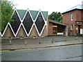
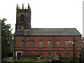
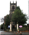
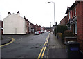
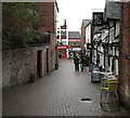
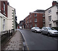
Photos of CW12 1TZ

Area Information
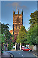
CW12 1TZ is a small, tightly knit residential postcode area in Cheshire, England, encompassing a cluster of homes near Congleton, a historic market town. With a population of 1,872, the area reflects the character of a traditional English parish, where the past and present coexist. Congleton itself lies at the edge of the Peak District, offering a mix of rural tranquillity and proximity to urban amenities. The town’s history dates back to the Domesday Book, with roots in Neolithic settlements and medieval trade. Today, CW12 1TZ is a quiet, family-oriented community, where residents benefit from the town’s historic infrastructure, including Congleton Railway Station, and its access to nearby retail and transport hubs. Daily life here is shaped by the surrounding landscape, with the river Dane and Congleton Park providing green spaces for recreation. The area’s small size means a strong sense of community, with local shops, schools, and transport links serving the needs of its residents. For those seeking a balance between tradition and modern convenience, CW12 1TZ offers a glimpse into a slower, more connected way of living.
- Area Type
- Postcode
- Area Size
- Not available
- Population
- 1872
- Population Density
- 2722 people/km²
The property market in CW12 1TZ is defined by its modest scale and focus on owner-occupied homes. With 51% of properties owned by residents, the area leans towards a stable, long-term housing stock rather than a high-turnover rental market. The predominant accommodation type is houses, which suggests a community of families and individuals seeking space and privacy. Given the small size of the postcode, the housing options are limited, meaning buyers may need to consider nearby areas for a broader selection. The presence of houses rather than flats aligns with the area’s suburban character, offering larger living spaces compared to urban centres. For those prioritising security and a settled environment, CW12 1TZ’s property market provides a reliable option, though its limited size may require flexibility in location. The mix of home ownership and rental properties also indicates a balance between established residents and those seeking more affordable housing.
House Prices in CW12 1TZ
No properties found in this postcode.
Energy Efficiency in CW12 1TZ
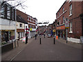
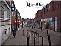
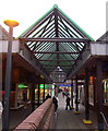
Living in CW12 1TZ offers a blend of local amenities and natural surroundings. The area is served by five retail outlets, including major supermarkets like Morrisons and Tesco, ensuring everyday shopping needs are met. For transport, five railway stations provide access to nearby towns, with Congleton Railway Station a 15-minute walk from the town centre. The nearby Congleton Park, a historic landmark opened in 1871, offers green space for leisure, walking, and community events. The park’s accessibility adds to the area’s appeal, providing a contrast to the suburban setting. While the data does not list specific dining or leisure venues, the presence of retail and transport options suggests a functional, self-contained lifestyle. The area’s small size means residents are likely to know their neighbours, fostering a close-knit community. The mix of historic and practical amenities supports a lifestyle that balances convenience with a connection to the local environment.
Amenities
Schools
The primary school nearest to CW12 1TZ is Saint Mary’s Catholic Primary School, which serves the local community with a focus on Catholic education. The school has an Ofsted rating of satisfactory, reflecting its adequacy in delivering education but leaving room for improvement. As a primary school, it caters to children aged 4–11, providing a foundation for families with young children. However, the data does not include secondary schools in the immediate area, which may require residents to travel to nearby towns for further education. The presence of a single primary school suggests that families in CW12 1TZ rely on this institution for early education, with the school’s performance and religious affiliation shaping the local educational landscape. While the rating indicates a functional school, prospective buyers should consider the availability of additional educational resources beyond primary level.
| Rank | School | Type | Entry gender | Ages |
|---|
Explore more schools in this area
Go to Schools tabDemographics
The residents of CW12 1TZ are predominantly adults aged 30–64, with a median age of 47. This suggests a community of established professionals, families, and retirees, reflecting a mature demographic profile. Home ownership is at 51%, indicating a mix of owner-occupied properties and rental homes. The area is characterised by houses rather than flats, which aligns with its small, suburban nature. The predominant ethnic group is White, though the data does not provide further breakdowns. The age distribution and ownership rates imply a stable, long-term resident base, with fewer young families or transient populations. The absence of specific deprivation data means that quality of life here is likely shaped by the area’s amenities and safety record. With a low crime score of 77, residents can expect a secure environment, and the lack of environmental constraints such as protected woodlands or flood risks further supports a practical, low-stress lifestyle.
Household Size
Accommodation Type
Tenure
Ethnic Group
Religion
Household Composition
Age
Household Deprivation
NS-SEC
Explore more demographic insights in this area
Go to Demographics tabPlanning
Planning Constraints
- Flood RiskPremium
- Ramsar Wetland SitesPremium
- Area of Outstanding Natural BeautyPremium
- Protected Nature ReservePremium
- Protected WoodlandPremium