Area Overview for CW12 1LY
Photos of CW12 1LY
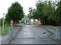
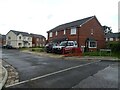

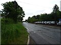
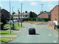
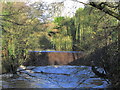
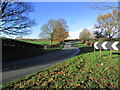
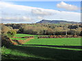

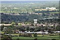
11 photos from this area
Area Information
Key information about the CW12 1LY including its size, population, and administrative classification.
- Area Type
- Postcode
- Area Size
- 1.7 hectares
- Population
- 2436
- Population Density
- 2794 people/km²
House Prices in CW12 1LY
49
Properties
£237,150
Average Sold Price
£159,950
Lowest Price
£315,000
Highest Price
Showing 49 properties
| Address | Type | Beds | Baths | Last Sale Price | Last Sale Date | |
|---|---|---|---|---|---|---|
| 25 Galloway Green, Congleton, CW12 1LY | Terraced | 3 | 2 | £283,000 | Aug 2025 | |
| 29 Galloway Green, Congleton, CW12 1LY | house | - | - | £280,000 | Feb 2022 | |
| 43 Galloway Green, Congleton, CW12 1LY | Detached | 3 | 2 | £225,000 | Dec 2021 | |
| 40 Galloway Green, Congleton, CW12 1LY | house | 4 | - | £287,000 | Sep 2021 | |
| 6 Galloway Green, Congleton, CW12 1LY | Semi-detached | 3 | 2 | £210,000 | Jan 2021 | |
| 38 Galloway Green, Congleton, CW12 1LY | Semi-detached | 3 | 2 | £227,000 | Feb 2018 | |
| 16 Galloway Green, Congleton, CW12 1LY | Detached | 4 | 2 | £235,000 | Aug 2016 | |
| 34 Galloway Green, Congleton, CW12 1LY | house | - | - | £239,950 | Sep 2015 | |
| 17 Galloway Green, Congleton, CW12 1LY | Terraced | 3 | 2 | £174,500 | Jun 2015 | |
| 45 Galloway Green, Congleton, CW12 1LY | house | - | - | £250,000 | Aug 2013 |
Page 1 of 5
Energy Efficiency in CW12 1LY
Amenities
Schools
| Rank | School | Type | Entry gender | Ages |
|---|
Explore more schools in this area
Go to Schools tabDemographics
Household Size
Two person
most common
Accommodation Type
Houses
most common
Tenure
86
majority
Ethnic Group
White
most common
Religion
N/A
most common
Household Composition
N/A
most common
Age
47
median
Adults (30-64 years)
most common
Household Deprivation
N/A
with no deprivation
NS-SEC
43
in Lower managerial occupations
Explore more demographic insights in this area
Go to Demographics tabPlanning
Planning Constraints
- Flood RiskPremium
- Ramsar Wetland SitesPremium
- Area of Outstanding Natural BeautyPremium
- Protected Nature ReservePremium
- Protected WoodlandPremium