Area Overview for CW11 9SY
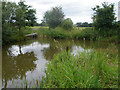
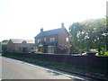
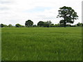
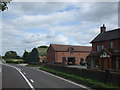
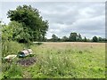
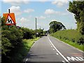
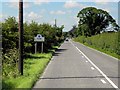
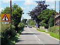
Photos of CW11 9SY


Area Information
Living in CW11 9SY offers a blend of rural tranquillity and accessible connectivity. This small postcode area, part of Cheshire East, sits approximately 2 miles east of Sandbach and 5 miles west of Congleton. With a population of 1,342 and a density of 119 people per square kilometre, it is a compact community rooted in the village of Arclid. The area’s history ties to the ancient parish of Sandbach St Mary, with notable features like Arclid Hall Farmhouse, a Grade II listed building dating to the 1700s. Daily life here is shaped by a mature demographic, with a median age of 47 and most residents aged 30–64. The area’s low crime risk and absence of environmental constraints, such as protected woodlands or wetlands, make it a stable, low-stress environment. While the village itself is small, its proximity to rail stations and major retailers ensures practical access to services. CW11 9SY is ideal for those seeking a quiet, owner-occupied lifestyle with easy links to nearby towns.
- Area Type
- Postcode
- Area Size
- Not available
- Population
- 1342
- Population Density
- 119 people/km²
The property market in CW11 9SY is dominated by owner-occupied homes, with 88% of properties owned by residents rather than rented. This high home ownership rate suggests a community of long-term residents, often families, who have invested in their homes. The accommodation type is predominantly houses, which aligns with the rural, low-density character of the area. This contrasts with urban areas where flats or apartments are more common. For buyers, this means the housing stock is limited in scale, with fewer new developments. However, the proximity to rail stations like Sandbach and Goostrey may offer opportunities to expand the search to nearby towns. The small size of the postcode area means properties are likely to be in close proximity to each other, with a focus on traditional, family homes. Buyers should consider the surrounding areas for a broader selection, but CW11 9SY itself offers a stable, low-maintenance market.
House Prices in CW11 9SY
No properties found in this postcode.
Energy Efficiency in CW11 9SY
The lifestyle in CW11 9SY is shaped by its proximity to retail hubs and rail networks. Within practical reach are five retail outlets, including Asda Sandbach, Co-op The, and Morrisons Daily, ensuring everyday shopping needs are met. These stores offer a mix of local and national brands, supporting both convenience and choice. The area’s rail stations—Holmes Chapel, Sandbach, and Goostrey—provide access to nearby towns, enabling easy travel for work, leisure, or socialising. While the village itself is small, its location near Sandbach and Congleton means residents can access larger amenities in these towns. The character of daily life is defined by a quiet, rural setting with practical links to urban services. The presence of a Grade II listed farmhouse and historical ties to Sandbach St Mary adds a layer of heritage to the area. For those valuing a balance between tranquillity and accessibility, CW11 9SY offers a compelling mix.
Amenities
Schools
| Rank | School | Type | Entry gender | Ages |
|---|
Explore more schools in this area
Go to Schools tabDemographics
The community in CW11 9SY is predominantly composed of adults aged 30–64, with a median age of 47. This suggests a mature, stable population, likely with established careers and families. Home ownership is high at 88%, indicating a strong presence of long-term residents rather than renters. The area is characterised by houses rather than flats, reflecting a traditional, family-oriented housing stock. The predominant ethnic group is White, with no data provided on other demographics. The low population density of 119 people per square kilometre reinforces the rural, low-pressure nature of the area. While no specific deprivation data is available, the high home ownership and low crime risk suggest a quality of life that prioritises security and community stability. The absence of significant age or ethnic diversity means the area is relatively homogeneous, which may appeal to those seeking a familiar, cohesive environment.
Household Size
Accommodation Type
Tenure
Ethnic Group
Religion
Household Composition
Age
Household Deprivation
NS-SEC
Explore more demographic insights in this area
Go to Demographics tabPlanning
Planning Constraints
- Flood RiskPremium
- Ramsar Wetland SitesPremium
- Area of Outstanding Natural BeautyPremium
- Protected Nature ReservePremium
- Protected WoodlandPremium