Area Overview for CW11 4RG
Photos of CW11 4RG

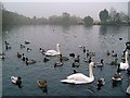
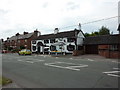
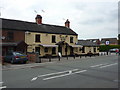
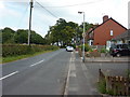
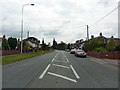
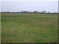
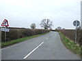
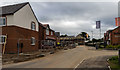
9 photos from this area
Area Information
Key information about the CW11 4RG including its size, population, and administrative classification.
- Area Type
- Postcode
- Area Size
- 3415 m²
- Population
- 1939
- Population Density
- 561 people/km²
House Prices in CW11 4RG
14
Properties
£176,000
Average Sold Price
£36,500
Lowest Price
£295,000
Highest Price
Showing 14 properties
| Address | Type | Beds | Baths | Last Sale Price | Last Sale Date | |
|---|---|---|---|---|---|---|
| 19 Alsager Road, Winterley, CW11 4RG | Semi-detached | 2 | 1 | £162,000 | Aug 2025 | |
| Bramley Cottage, 7 Alsager Road, Winterley, CW11 4RG | Terraced | 2 | 1 | £295,000 | Feb 2025 | |
| 21 Alsager Road, Winterley, CW11 4RG | Semi-detached | 1 | 1 | £280,000 | Jul 2023 | |
| 1 Alsager Road, Winterley, CW11 4RG | house | - | - | £162,000 | Dec 2020 | |
| 17 Alsager Road, Winterley, CW11 4RG | Semi-detached | 2 | - | £179,000 | Jun 2014 | |
| 11 Alsager Road, Winterley, CW11 4RG | Bungalow | - | - | £160,000 | Jun 2008 | |
| 25 Alsager Road, Winterley, CW11 4RG | house | - | - | £141,000 | May 2007 | |
| 31 Alsager Road, Winterley, CW11 4RG | Semi-detached | 3 | - | £182,500 | May 2006 | |
| 23 Alsager Road, Winterley, CW11 4RG | Semi-detached | - | - | £162,000 | Dec 2004 | |
| 29 Alsager Road, Winterley, CW11 4RG | Semi-detached | - | - | £36,500 | Jun 1997 |
Page 1 of 2
Energy Efficiency in CW11 4RG
Amenities
Schools
| Rank | School | Type | Entry gender | Ages |
|---|
Explore more schools in this area
Go to Schools tabDemographics
Household Size
Two person
most common
Accommodation Type
Houses
most common
Tenure
85
majority
Ethnic Group
White
most common
Religion
N/A
most common
Household Composition
N/A
most common
Age
47
median
Adults (30-64 years)
most common
Household Deprivation
N/A
with no deprivation
NS-SEC
44
in Lower managerial occupations
Explore more demographic insights in this area
Go to Demographics tabPlanning
Planning Constraints
- Flood RiskPremium
- Ramsar Wetland SitesPremium
- Area of Outstanding Natural BeautyPremium
- Protected Nature ReservePremium
- Protected WoodlandPremium