Area Overview for CW11 4RE
Photos of CW11 4RE

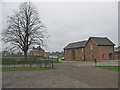

14 photos from this area
Area Information
Key information about the CW11 4RE including its size, population, and administrative classification.
- Area Type
- Postcode
- Area Size
- 30.9 hectares
- Population
- 2166
- Population Density
- 729 people/km²
House Prices in CW11 4RE
11
Properties
£216,000
Average Sold Price
£57,000
Lowest Price
£365,000
Highest Price
Showing 11 properties
| Address | Type | Beds | Baths | Last Sale Price | Last Sale Date | |
|---|---|---|---|---|---|---|
| Wheelock Hall Farm Cottage, Crewe Road, Sandbach, CW11 4RE | Detached | - | - | £260,000 | Dec 2019 | |
| Linden Lea, Crewe Road, Winterley, CW11 4RE | Bungalow | 3 | 2 | £365,000 | Nov 2015 | |
| 1, Hawthorn Villas, Crewe Road, Winterley, CW11 4RE | Semi-detached | - | - | £57,000 | Aug 1999 | |
| Hill View, Crewe Road, Winterley, CW11 4RE | house | - | - | £182,000 | Mar 1998 | |
| The Old Vicarage, Crewe Road, Winterley, CW11 4RE | undefined | - | - | - | - | |
| Astley House, Crewe Road, Winterley, CW11 4RE | house | - | - | - | - | |
| 2, Hawthorn Villas, Crewe Road, Winterley, CW11 4RE | Semi-detached | - | - | - | - | |
| Fernwood, Crewe Road, Winterley, CW11 4RE | Detached | - | - | - | - | |
| Holiday Barn 2, Wheelock Hall Farm, Crewe Road, Sandbach, CW11 4RE | hotel | - | - | - | - | |
| Holiday Barn 1, Wheelock Hall Farm, Crewe Road, Sandbach, CW11 4RE | house | - | - | - | - |
Page 1 of 2
Energy Efficiency in CW11 4RE
Amenities
Schools
| Rank | School | Type | Entry gender | Ages |
|---|
Explore more schools in this area
Go to Schools tabDemographics
Household Size
Two person
most common
Accommodation Type
Houses
most common
Tenure
81
majority
Ethnic Group
White
most common
Religion
N/A
most common
Household Composition
N/A
most common
Age
47
median
Adults (30-64 years)
most common
Household Deprivation
N/A
with no deprivation
NS-SEC
41
in Lower managerial occupations
Explore more demographic insights in this area
Go to Demographics tabPlanning
Planning Constraints
- Flood RiskPremium
- Ramsar Wetland SitesPremium
- Area of Outstanding Natural BeautyPremium
- Protected Nature ReservePremium
- Protected WoodlandPremium