Area Overview for CW11 4NY
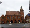
Photos of CW11 4NY

Area Information
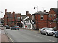
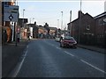
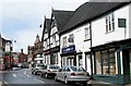
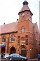
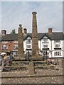
Living in CW11 4NY means inhabiting a small, densely populated residential cluster in Cheshire East, England. The postcode covers 3,834 square metres, housing 1,349 residents in a compact area with a population density of 351,845 people per square kilometre. This is the market town of Sandbach, a historic settlement with roots in the Domesday Book of 1086, known for its Anglo-Saxon Sandbach Crosses and Thursday market. Daily life here is shaped by its mix of heritage and practicality: the town centre hosts shops, bars, and the weekly Farmers’ Market, while nearby rail stations connect to Crewe, Holmes Chapel, and beyond. The area’s low crime score of 97/100 and absence of environmental constraints like AONB or protected woodlands make it a stable, accessible place. With 71% home ownership and a predominance of houses, CW11 4NY offers a quiet, family-oriented environment where historical charm meets modern convenience.
- Area Type
- Postcode
- Area Size
- 3834 m²
- Population
- 1349
- Population Density
- 3076 people/km²
The property market in CW11 4NY is characterised by high home ownership (71%) and a predominance of houses, reflecting a residential area with limited rental activity. As a small postcode cluster, the housing stock is likely limited to individual properties rather than larger developments, which could make the market competitive for buyers. The focus on owner-occupied homes suggests a community of long-term residents, potentially driving demand for properties with established value. Given the area’s compact size, buyers should consider nearby postcodes for additional options. The lack of flats or apartments means the market caters primarily to those seeking single-family homes, aligning with the demographic profile of middle-aged adults.
House Prices in CW11 4NY
Showing 8 properties
| Address | Type | Beds | Baths | Last Sale Price | Last Sale Date | |
|---|---|---|---|---|---|---|
| 3 Second Avenue, Sandbach, CW11 4NY | Semi-detached | 3 | 1 | £303,000 | Feb 2023 | |
| 7 Second Avenue, Sandbach, CW11 4NY | house | 3 | - | £240,000 | Nov 2020 | |
| 6 Second Avenue, Sandbach, CW11 4NY | Semi-detached | 3 | 1 | £195,000 | Sep 2020 | |
| 4 Second Avenue, Sandbach, CW11 4NY | house | - | - | £147,000 | May 2010 | |
| 5 Second Avenue, Sandbach, CW11 4NY | Semi-detached | - | - | £165,000 | Mar 2006 | |
| 8 Second Avenue, Sandbach, CW11 4NY | Semi-detached | - | - | £167,000 | Sep 2004 | |
| 2 Second Avenue, Sandbach, CW11 4NY | Semi-detached | - | - | - | - | |
| 1 Second Avenue, Sandbach, CW11 4NY | house | - | - | - | - |
Energy Efficiency in CW11 4NY
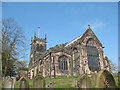
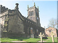
Life in CW11 4NY is enriched by nearby amenities that blend practicality with local character. The area’s retail offerings include Waitrose Sandbach, Aldi Arclid, and Iceland Sandbach, providing a range of shopping options within walking distance. The town’s Thursday market and monthly Farmers’ Market add a sense of tradition and community, while the town centre hosts shops and bars that cater to daily needs. Rail stations within practical reach—Sandbach, Holmes Chapel, and Crewe—enhance mobility, connecting residents to broader networks. The presence of historical sites like the Anglo-Saxon Sandbach Crosses and St Mary’s Church adds cultural depth, making daily life here a balance of convenience, heritage, and accessibility.
Amenities
Schools
The nearest school to CW11 4NY is Wheelock Primary School, which serves the local community with a good Ofsted rating. This primary school is a key asset for families, offering a reliable education for younger children. The absence of secondary schools in the immediate area means parents may need to consider commuting to nearby towns for secondary education. However, the presence of a well-rated primary school supports the area’s appeal for families seeking a stable educational environment. The school’s location within practical reach of residents underscores the convenience of living in a town with established infrastructure for children’s needs.
| Rank | School | Type | Entry gender | Ages |
|---|
Explore more schools in this area
Go to Schools tabDemographics
The community in CW11 4NY is predominantly middle-aged, with a median age of 47 and the most common age range being adults aged 30–64. This suggests a settled, mature population, likely with established careers and family ties. Home ownership is high at 71%, reflecting a stable housing market where most residents live in their own homes rather than renting. The accommodation type is primarily houses, indicating a lack of high-density housing or flats. The predominant ethnic group is White, which aligns with broader demographic trends in the region. The absence of specific data on deprivation or diversity means the area’s social dynamics are not explicitly detailed, but the high home ownership and age profile suggest a community focused on long-term residency and local continuity.
Household Size
Accommodation Type
Tenure
Ethnic Group
Religion
Household Composition
Age
Household Deprivation
NS-SEC
Explore more demographic insights in this area
Go to Demographics tabPlanning
Planning Constraints
- Flood RiskPremium
- Ramsar Wetland SitesPremium
- Area of Outstanding Natural BeautyPremium
- Protected Nature ReservePremium
- Protected WoodlandPremium