Area Overview for CW11 3TU
Photos of CW11 3TU
Area Information
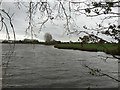
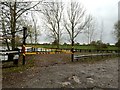
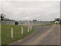
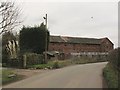
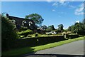
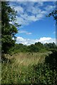
CW11 3TU is a small, residential postcode area in Cheshire, England, covering just 5.4 hectares with a population of 1,707 people. Its low population density of 55 people per square kilometre reflects a quiet, rural character, typical of the broader Moston area. Historically part of the ancient parish of Warmingham, this region has evolved into a low-population civil parish with a distinct sense of community. The area is defined by its modest size and the presence of nearby hamlets like Moston Green, which contribute to its rural charm. Daily life here is likely shaped by proximity to local amenities, historic sites such as Moston Hall, and the surrounding Cheshire countryside. With a median age of 47 and a strong majority of adults aged 30–64, the community balances stability with a focus on family and local traditions. The area’s small footprint means residents are likely to know their neighbours, and the lack of major urban infrastructure reinforces its appeal for those seeking a peaceful, low-density lifestyle.
- Area Type
- Postcode
- Area Size
- 5.4 hectares
- Population
- 1707
- Population Density
- 55 people/km²
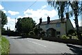
The property market in CW11 3TU is dominated by owner-occupied homes, with 85% of residents living in houses rather than flats or apartments. This reflects the area’s rural character and the preference for larger, private properties typical of Cheshire’s outskirts. The small size of the postcode area—just 5.4 hectares—means the housing stock is limited, likely comprising a mix of older and newer homes. Given the high home ownership rate, the market is not driven by rental demand but by long-term residents seeking stability. Buyers considering this area may find limited options, but the properties available are likely to be in good condition, with low environmental risks and strong safety records. The lack of major planning constraints, such as protected woodlands or AONB designations, also makes it an attractive option for those prioritising ease of development or renovation. However, the small size of the area means prospective buyers should consider nearby towns like Sandbach or Crewe for additional housing choices.
House Prices in CW11 3TU
Showing 1 properties
| Address | Type | Beds | Baths | Last Sale Price | Last Sale Date | |
|---|---|---|---|---|---|---|
| Roof Solar Panels, Newfield Fabrications Co Limited, Hall Lane, Moston, CW11 3TU | Industrial | - | - | - | - |
Energy Efficiency in CW11 3TU
The lifestyle in CW11 3TU is shaped by its proximity to local amenities such as Co-op Elworth and Aldi Arclid, which provide essential retail services within practical reach. These shops cater to daily needs, reducing the necessity for long journeys to larger towns. The area’s small size means residents can access these venues without significant travel time, enhancing convenience. While the data does not mention parks or leisure facilities, the surrounding countryside and historic sites like Moston Hall suggest opportunities for outdoor activities and cultural exploration. The presence of rail stations further expands access to dining, entertainment, and other services in nearby towns. Overall, the lifestyle here balances rural tranquillity with the practicality of nearby amenities, making it appealing for those seeking a self-contained, low-stress environment.
Amenities
Schools
The nearest school to CW11 3TU is Brereton CofE Primary School, which serves the local community. The data lists this school twice, but it is the only named educational institution provided. As a primary school, it caters to younger children, though no secondary schools or Ofsted ratings are mentioned in the data. This suggests that families may need to look further afield for secondary education, potentially in nearby towns like Sandbach or Congleton. The presence of a primary school indicates a commitment to local education, but the absence of detailed performance metrics means prospective homebuyers should investigate further to assess the quality of schooling. For those prioritising proximity to schools, the availability of a primary institution is a practical advantage, though secondary options may require commuting.
| Rank | School | Type | Entry gender | Ages |
|---|
Explore more schools in this area
Go to Schools tabDemographics
The population of CW11 3TU is predominantly adults aged 30–64, with a median age of 47. This suggests a mature, established community with a focus on family living and long-term residency. Home ownership is exceptionally high at 85%, indicating a stable, settled population with a strong preference for owning property. The area is characterised by houses rather than flats, aligning with its rural and semi-rural nature. The predominant ethnic group is White, with no data provided on other demographics. The age profile and ownership figures together suggest a community that is largely self-sufficient, with fewer transient residents. This demographic structure likely supports a local economy centred on services and small-scale retail, rather than large-scale commercial activity. The absence of specific data on deprivation or income levels means the quality of life here is inferred from the low crime rates and environmental safety assessments.
Household Size
Accommodation Type
Tenure
Ethnic Group
Religion
Household Composition
Age
Household Deprivation
NS-SEC
Explore more demographic insights in this area
Go to Demographics tabPlanning
Planning Constraints
- Flood RiskPremium
- Ramsar Wetland SitesPremium
- Area of Outstanding Natural BeautyPremium
- Protected Nature ReservePremium
- Protected WoodlandPremium