Area Overview for CW11 3QN
Photos of CW11 3QN
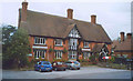

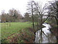


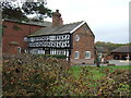


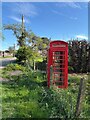
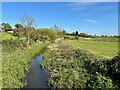


29 photos from this area
Area Information
Key information about the CW11 3QN including its size, population, and administrative classification.
- Area Type
- Postcode
- Area Size
- 1.5 km²
- Population
- 1553
- Population Density
- 72 people/km²
House Prices in CW11 3QN
21
Properties
£281,467
Average Sold Price
£62,500
Lowest Price
£387,500
Highest Price
Showing 21 properties
| Address | Type | Beds | Baths | Last Sale Price | Last Sale Date | |
|---|---|---|---|---|---|---|
| Weir Cottage, School Lane, Warmingham, CW11 3QN | Terraced | 2 | 2 | £108,750 | May 2021 | |
| Millers Cottage, School Lane, Warmingham, CW11 3QN | Detached | 3 | 1 | £375,000 | Aug 2020 | |
| Cornmill House, School Lane, Warmingham, CW11 3QN | Semi-detached | 4 | 2 | £339,000 | Mar 2018 | |
| Avondale, School Lane, Warmingham, CW11 3QN | house | - | - | £338,000 | Dec 2016 | |
| Avalon, School Lane, Warmingham, CW11 3QN | Semi-detached | 4 | 2 | £387,500 | Nov 2016 | |
| Bridge Cottage, School Lane, Warmingham, CW11 3QN | Terraced | 2 | - | £62,500 | Nov 2016 | |
| Millers Race, School Lane, Warmingham, CW11 3QN | Semi-detached | 4 | 2 | £349,950 | Mar 2006 | |
| Hill Top Cottage, School Lane, Warmingham, CW11 3QN | Bungalow | 1 | 1 | £382,500 | Jul 2003 | |
| The Limes, School Lane, Warmingham, CW11 3QN | Flat | - | - | £190,000 | Jul 1996 | |
| Woodlands, School Lane, Warmingham, CW11 3QN | Detached | 5 | 5 | - | - |
Page 1 of 3
Energy Efficiency in CW11 3QN
Amenities
Schools
| Rank | School | Type | Entry gender | Ages |
|---|
Explore more schools in this area
Go to Schools tabDemographics
Household Size
Family (3-5 people)
most common
Accommodation Type
Houses
most common
Tenure
86
majority
Ethnic Group
White
most common
Religion
N/A
most common
Household Composition
N/A
most common
Age
47
median
Adults (30-64 years)
most common
Household Deprivation
N/A
with no deprivation
NS-SEC
41
in Lower managerial occupations
Explore more demographic insights in this area
Go to Demographics tabPlanning
Planning Constraints
- Flood RiskPremium
- Ramsar Wetland SitesPremium
- Area of Outstanding Natural BeautyPremium
- Protected Nature ReservePremium
- Protected WoodlandPremium