Area Overview for CW11 3JA
Photos of CW11 3JA


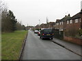


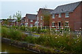
71 photos from this area
Area Information
Key information about the CW11 3JA including its size, population, and administrative classification.
- Area Type
- Postcode
- Area Size
- 1.1 hectares
- Population
- 2066
- Population Density
- 1593 people/km²
House Prices in CW11 3JA
7
Properties
-
Average Sold Price
-
Lowest Price
-
Highest Price
Showing 7 properties
| Address | Type | Beds | Baths | Last Sale Price | Last Sale Date | |
|---|---|---|---|---|---|---|
| Crewe Colour Printers, Springvale Industrial Estate, Moston Road, Sandbach, CW11 3JA | Industrial | - | - | - | - | |
| Konnekt Offsite Limited, 4 Millbuck Way, Sandbach, CW11 3JA | Industrial | - | - | - | - | |
| Carlton Fuels Ltd, Plot 2, Springvale Industrial Estate, Moston Road, Sandbach, CW11 3JA | warehouse | - | - | - | - | |
| Highbury Homes, 3 Millbuck Way, Sandbach, CW11 3JA | Office | - | - | - | - | |
| Martrim Ltd, Plot 10, Springvale Industrial Estate, Moston Road, Sandbach, CW11 3JA | Industrial | - | - | - | - | |
| Olympian Sheds, Plot 8, Springvale Industrial Estate, Moston Road, Sandbach, CW11 3JA | Industrial | - | - | - | - | |
| Springvale Mot And Repair Centre, Springvale Industrial Estate, Millbuck Way, Sandbach, CW11 3JA | Industrial | - | - | - | - |
Energy Efficiency in CW11 3JA
Amenities
Schools
| Rank | School | Type | Entry gender | Ages |
|---|
Explore more schools in this area
Go to Schools tabDemographics
Household Size
Two person
most common
Accommodation Type
Houses
most common
Tenure
81
majority
Ethnic Group
White
most common
Religion
N/A
most common
Household Composition
N/A
most common
Age
47
median
Adults (30-64 years)
most common
Household Deprivation
N/A
with no deprivation
NS-SEC
44
in Lower managerial occupations
Explore more demographic insights in this area
Go to Demographics tabPlanning
Planning Constraints
- Flood RiskPremium
- Ramsar Wetland SitesPremium
- Area of Outstanding Natural BeautyPremium
- Protected Nature ReservePremium
- Protected WoodlandPremium