Area Overview for CW11 2ND
Photos of CW11 2ND
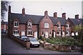
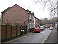

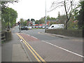
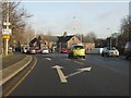


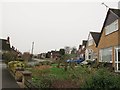
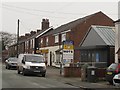
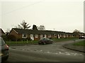
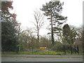
81 photos from this area
Area Information
Key information about the CW11 2ND including its size, population, and administrative classification.
- Area Type
- Postcode
- Area Size
- 5.7 hectares
- Population
- 1426
- Population Density
- 1074 people/km²
House Prices in CW11 2ND
39
Properties
£218,850
Average Sold Price
£59,000
Lowest Price
£650,000
Highest Price
Showing 39 properties
| Address | Type | Beds | Baths | Last Sale Price | Last Sale Date | |
|---|---|---|---|---|---|---|
| 58 Manor Road, Sandbach, CW11 2ND | Detached | 3 | 1 | £330,000 | May 2025 | |
| 81 Manor Road, Sandbach, CW11 2ND | Semi-detached | 3 | 2 | £335,000 | Mar 2025 | |
| 40 Manor Road, Sandbach, CW11 2ND | house | - | - | £296,000 | Aug 2021 | |
| Conker Tree House, Manor Road, Sandbach, CW11 2ND | Detached | 5 | - | £650,000 | Jun 2021 | |
| 52 Manor Road, Sandbach, CW11 2ND | Detached | 3 | 1 | £360,000 | Mar 2021 | |
| 9 Manor Road, Sandbach, CW11 2ND | Detached | 3 | 2 | £275,000 | Apr 2017 | |
| 42 Manor Road, Sandbach, CW11 2ND | house | - | - | £180,000 | Nov 2016 | |
| 56 Manor Road, Sandbach, CW11 2ND | Detached | 4 | 2 | £235,000 | Nov 2015 | |
| 38 Manor Road, Sandbach, CW11 2ND | house | - | - | £183,000 | Aug 2015 | |
| 50 Manor Road, Sandbach, CW11 2ND | Detached | - | - | £210,000 | Jul 2012 |
Page 1 of 4
Energy Efficiency in CW11 2ND
Amenities
Schools
| Rank | School | Type | Entry gender | Ages |
|---|
Explore more schools in this area
Go to Schools tabDemographics
Household Size
Two person
most common
Accommodation Type
Houses
most common
Tenure
82
majority
Ethnic Group
White
most common
Religion
N/A
most common
Household Composition
N/A
most common
Age
47
median
Adults (30-64 years)
most common
Household Deprivation
N/A
with no deprivation
NS-SEC
40
in Lower managerial occupations
Explore more demographic insights in this area
Go to Demographics tabPlanning
Planning Constraints
- Flood RiskPremium
- Ramsar Wetland SitesPremium
- Area of Outstanding Natural BeautyPremium
- Protected Nature ReservePremium
- Protected WoodlandPremium