Area Overview for CW11 2LE
Photos of CW11 2LE


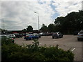
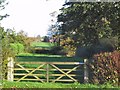


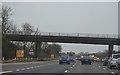
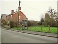

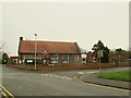
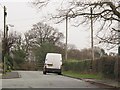
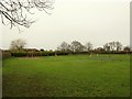
73 photos from this area
Area Information
Key information about the CW11 2LE including its size, population, and administrative classification.
- Area Type
- Postcode
- Area Size
- 2.1 hectares
- Population
- 1426
- Population Density
- 1074 people/km²
House Prices in CW11 2LE
59
Properties
£171,985
Average Sold Price
£34,055
Lowest Price
£425,000
Highest Price
Showing 59 properties
| Address | Type | Beds | Baths | Last Sale Price | Last Sale Date | |
|---|---|---|---|---|---|---|
| 116 Heath Road, Sandbach, CW11 2LE | Detached | 3 | 1 | £355,000 | Jul 2025 | |
| 203 Heath Road, Sandbach, CW11 2LE | Bungalow | 3 | 1 | £270,000 | Nov 2024 | |
| 138 Heath Road, Sandbach, CW11 2LE | Semi-detached | 3 | 1 | £182,500 | Oct 2024 | |
| 205 Heath Road, Sandbach, CW11 2LE | Retail | 3 | 1 | £295,000 | Oct 2022 | |
| 94A Heath Road, Sandbach, CW11 2LE | house | - | - | £425,000 | Aug 2022 | |
| 137 Heath Road, Sandbach, CW11 2LE | Terraced | 2 | 1 | £166,010 | Nov 2021 | |
| 151 Heath Road, Sandbach, CW11 2LE | Terraced | 2 | 1 | £280,000 | Sep 2021 | |
| 195 Heath Road, Sandbach, CW11 2LE | Semi-detached | 3 | 1 | £208,000 | Jul 2020 | |
| 173 Heath Road, Sandbach, CW11 2LE | house | - | - | £152,000 | Nov 2019 | |
| 171 Heath Road, Sandbach, CW11 2LE | house | - | - | £220,000 | Aug 2019 |
Page 1 of 6
Energy Efficiency in CW11 2LE
Amenities
Schools
| Rank | School | Type | Entry gender | Ages |
|---|
Explore more schools in this area
Go to Schools tabDemographics
Household Size
Two person
most common
Accommodation Type
Houses
most common
Tenure
82
majority
Ethnic Group
White
most common
Religion
N/A
most common
Household Composition
N/A
most common
Age
47
median
Adults (30-64 years)
most common
Household Deprivation
N/A
with no deprivation
NS-SEC
40
in Lower managerial occupations
Explore more demographic insights in this area
Go to Demographics tabPlanning
Planning Constraints
- Flood RiskPremium
- Ramsar Wetland SitesPremium
- Area of Outstanding Natural BeautyPremium
- Protected Nature ReservePremium
- Protected WoodlandPremium