Area Overview for CW11 1RF
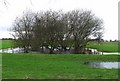
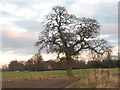
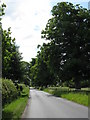
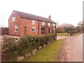
Photos of CW11 1RF

Area Information
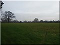
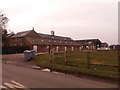
Living in CW11 1RF means settling into Bradwall, a small civil parish located approximately 3.2 km northwest of Sandbach. This specific postcode cluster covers just 10 hectares of land within Cheshire East, hosting a population of 1,707 residents. The setting is defined by its history and its position away from the immediate urban centre, offering a quiet residential environment rather than a bustling town centre experience. You are accessing a community where the landscape has evolved from uncultivated moorland into a established residential area, originally recorded in the 13th century as a manorial estate. The name Bradwall itself derives from Old English, suggesting a landscape shaped by broad springs thousands of years ago. Today, the area remains firmly rooted in its local identity, separated historically from the Ancient Parish of Sandbach until the civil parish was created in 1867. While you do not live inside the historic Bradwall Hall, which was demolished in the early 20th century, the locality retains connections to the area's past through the surviving Wesleyan Chapel on Ward's Lane. Your daily life here is characterised by proximity to a rural history yet within practical reach of the larger amenities found in Sandbach and Holmes Chapel. This balance makes CW11 1RF suitable for those seeking a settled village atmosphere without total isolation from broader transport and retail networks.
- Area Type
- Postcode
- Area Size
- 10.0 hectares
- Population
- 1707
- Population Density
- 55 people/km²
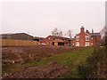
The property market in CW11 1RF is almost entirely composed of single-family homes, with houses forming the dominant accommodation type. Home ownership stands at 85%, which paints a clear picture of a residential zone where buyers are typically purchasing to stay rather than investing for short-term rental yields. You will not encounter high-rise flats or large blocks of flats in this specific area, as the housing stock is almost exclusively detached or semi-detached properties typical of a village setting. This high rate of ownership indicates that the area attracts purchasers who value the security and autonomy of a freehold property. The market caters to families and mature couples who can afford to buy rather than rent, given the limited rental supply implied by such high ownership figures. For a prospective buyer looking at CW11 1RF, the available homes are likely to be single-unit dwellings suitable for living rather than commercial adaptation. The small physical size of the postcode area, covering only 10 hectares, further constrains the market, meaning inventory turnover is likely slower than in larger developments. Prices may reflect the desirability of owning a home in a low-density environment with access to nearby stations, but you must view this as a market for settled buyers rather than mobile tenants or speculators.
House Prices in CW11 1RF
Showing 2 properties
| Address | Type | Beds | Baths | Last Sale Price | Last Sale Date | |
|---|---|---|---|---|---|---|
| Bradwall Manor, Pillar Box Lane, Bradwall, CW11 1RF | Detached | - | - | - | - | |
| Store And Premises, Bradwall Manor, Pillar Box Lane, Bradwall, CW11 1RF | warehouse | - | - | - | - |
Energy Efficiency in CW11 1RF
Your lifestyle in CW11 1RF is shaped by access to a curated list of amenities reached by car or public transport. For retail needs, you have five major options within practical reach, including Asda Sandbach, Morrisons Daily, and Aldi Arclid. These supermarkets provide sufficient choice for weekly grocery shopping and occasional bulk purchases without the need to travel long distances. Transport links are equally convenient, with five railway stations nearby including Sandbach Railway Station, Holmes Chapel Railway Station, and Goostrey Railway Station. These stations allow you to connect to national networks while remaining within the Cheshire East unitary authority. Leisure activities are less centralized within the immediate 10 hecetre zone, but the Wesleyan Chapel on Ward's Lane offers fortnightly religious services for community engagement. The local character is defined by these practical services rather than high-end dining or entertainment venues, which are located in the neighbouring town of Sandbach. You will find that daily errands are manageable, and the town of Sandbach provides the additional shopping and leisure facilities that a small village cannot sustain alone. This distribution of amenities means you enjoy the quiet of a rural postcode with the convenience of town services just minutes away.
Amenities
Schools
Families living in CW11 1RF have access to Brereton CofE Primary School, which serves the local community as a primary education establishment. This is the only specific school named in the immediate vicinity data, and it caters to children before they typically transition to secondary education elsewhere in Cheshire East. As a Church of England primary school, it offers a specific religious ethos that may appeal to families seeking denominational education for their children. While the data does not list secondary schools within the immediate postcode cluster, the presence of Brereton CofE Primary School indicates that early childhood education is locally accessible. You may need to travel beyond the 1390 hectares of the surrounding unitary authority to find secondary options, but the primary provision is settled within the Bradwall area. The availability of this single primary institution suggests a neighbourhood that functions as a feeder for a wider network of schools rather than a self-contained education zone. For parents considering homes in CW11 1RF, the proximity of Brereton CofE Primary School is a key factor in daily logistics. The school's existence confirms that the area supports young families despite the high median age, likely because some families move into this community as children approach school age or while their children are already in the local system through proximity.
| Rank | School | Type | Entry gender | Ages |
|---|
Explore more schools in this area
Go to Schools tabDemographics
The community within CW11 1RF is defined by a stable, mature demographic structure. The median age stands at 47 years, indicating that adults between the ages of 30 and 64 represent the most common age range in this neighbourhood. A significant 85% of residents own their homes, reflecting a settled population with deep roots in the local area. Almost all accommodation in this 10 hectare zone consists of houses, which aligns with the high rate of home ownership and the nature of a village parish. The demographic profile shows a predominantly White ethnic group, consistent with many of the older, established parishes in Cheshire East. This high percentage of homeowners suggests a low turnover of residents and a community that values stability. You will find an environment where families and long-term residents form the backbone of society rather than a transient workforce. The absence of large rental blocks or student accommodation reinforces this picture of a traditional residential cluster. Your neighbours are likely to be settled individuals or families who have chosen this specific postcode for its community feel and lower density compared to wider urban centres. This demographic consistency contributes to a predictable social environment where local knowledge and neighbourly interactions are common.
Household Size
Accommodation Type
Tenure
Ethnic Group
Religion
Household Composition
Age
Household Deprivation
NS-SEC
Explore more demographic insights in this area
Go to Demographics tabPlanning
Planning Constraints
- Flood RiskPremium
- Ramsar Wetland SitesPremium
- Area of Outstanding Natural BeautyPremium
- Protected Nature ReservePremium
- Protected WoodlandPremium