Area Overview for CW11 1QB
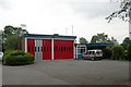
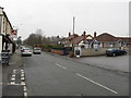
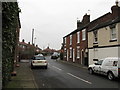
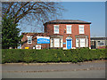
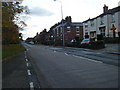
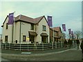
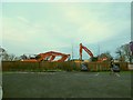
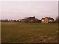
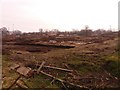
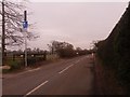
Photos of CW11 1QB
Area Information
Living in CW11 1QB means being part of a small, tightly knit residential cluster in the Cheshire Plain, where history and modernity coexist. The area’s population of 2,063 residents, spread across 918 people per square kilometre, reflects a compact community with a strong sense of local identity. Sandbach, the market town encompassing this postcode, has roots stretching back to the Domesday Book of 1086, with its Thursday market and annual Farmers’ Market still drawing locals and visitors. The town’s charm lies in its blend of heritage — such as the Anglo-Saxon Sandbach Crosses — and practical amenities. Daily life here is shaped by proximity to rail networks, including Sandbach and Alsager stations, and a network of local shops, from Aldi to Morrisons. The area’s compact size means residents can walk or cycle to key services, while its low crime rate and lack of environmental constraints make it appealing for families and professionals alike.
- Area Type
- Postcode
- Area Size
- Not available
- Population
- 2063
- Population Density
- 918 people/km²
The property market in CW11 1QB is characterised by a high rate of home ownership — 87% of homes are owner-occupied — suggesting a community of long-term residents rather than a transient rental market. The predominant accommodation type is houses, which implies a focus on single-family homes rather than apartments or terraced housing. This aligns with the area’s small, residential nature, where the limited number of properties means the market is likely to be competitive for buyers. The compact size of the postcode area means that properties are closely spaced, with limited scope for expansion. For buyers, this suggests a need to act quickly, as the stock is finite. The high ownership rate also indicates strong local attachment, which can stabilise property values but may reduce availability for new buyers. The mix of older and newer housing stock reflects Sandbach’s historical development as a market town with roots in 16th-century trade.
House Prices in CW11 1QB
No properties found in this postcode.
Energy Efficiency in CW11 1QB
The lifestyle in CW11 1QB is defined by a mix of traditional market town charm and practical amenities. Within walking distance are shops such as Aldi Arclid, Morrisons Daily, and Iceland Sandbach, offering everyday essentials. The area’s retail and rail networks are complemented by Sandbach’s Thursday market, held on Scotch Common, and the monthly Farmers’ Market, which adds a community-focused dimension to local life. The town centre hosts bars and shops, while historical sites like the Anglo-Saxon Sandbach Crosses provide cultural interest. Parks and open spaces are not explicitly detailed in the data, but the proximity to the Cheshire Plain suggests opportunities for outdoor activities. The blend of retail, transport, and heritage makes daily life convenient, with a focus on local engagement and accessibility.
Amenities
Schools
Residents of CW11 1QB have access to four primary schools within the area: Offley Junior School, Offley Infant School, Offley Primary School, and Offley Primary Academy. The latter holds a ‘good’ Ofsted rating, offering families a reputable option for early education. The concentration of primary schools suggests a strong local educational infrastructure, catering to the needs of families with young children. The presence of multiple schools may also indicate a larger student population in the surrounding area, though specific data on secondary schools is not provided. The mix of school types — including a primary academy with a formal rating — ensures variety in educational options. For parents, this cluster of schools supports a seamless transition from early years to primary education, reducing the need for long commutes. The proximity of these institutions to residential areas further enhances the area’s appeal for families.
| Rank | School | Type | Entry gender | Ages |
|---|
Explore more schools in this area
Go to Schools tabDemographics
The population of CW11 1QB has a median age of 47, with the majority of residents falling within the 30-64 age range. This suggests a community of established adults, many of whom are likely to be homeowners, as 87% of homes here are owner-occupied. The predominant accommodation type is houses, reflecting a residential area with larger properties rather than flats or apartments. The predominant ethnic group is White, which aligns with broader trends in the region. The high home ownership rate and mature age profile indicate a stable, long-term resident base with limited turnover. This demographic profile supports a quiet, family-oriented environment, where the majority of households are likely to be couples or single adults in their prime working years. The absence of specific data on deprivation or diversity means the area’s social fabric remains largely defined by its historical and economic ties to Sandbach’s market traditions.
Household Size
Accommodation Type
Tenure
Ethnic Group
Religion
Household Composition
Age
Household Deprivation
NS-SEC
Explore more demographic insights in this area
Go to Demographics tabPlanning
Planning Constraints
- Flood RiskPremium
- Ramsar Wetland SitesPremium
- Area of Outstanding Natural BeautyPremium
- Protected Nature ReservePremium
- Protected WoodlandPremium