Area Overview for CW11 0SZ
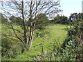
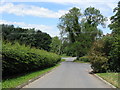
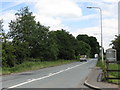
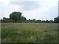
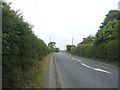
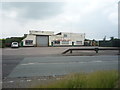
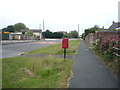
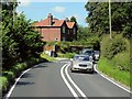
Photos of CW11 0SZ
Area Information
CW11 0SZ is a small, tightly knit residential cluster nestled in Cheshire East, England. With a population of 1,342 spread across a low-density area, it offers a quiet, rural lifestyle balanced with practical connectivity. The area’s character is shaped by its proximity to Arclid, a village with historical roots dating back to the ancient parish of Sandbach St Mary. While the 2023 population figure appears higher than historical records, the area retains its charm as a small community with a focus on stability and low risk. Residents benefit from a mix of convenience and tranquillity, with nearby towns like Sandbach and Congleton within easy reach. The area’s safety profile is strong, with a crime risk score of 100 (lowest possible) and no significant environmental hazards. For those seeking a peaceful yet accessible home, CW11 0SZ provides a blend of rural charm and modern amenities.
- Area Type
- Postcode
- Area Size
- Not available
- Population
- 1342
- Population Density
- 119 people/km²
The property market in CW11 0SZ is dominated by owner-occupied homes, with 88% of properties in private hands. The area’s housing stock consists largely of houses, which is unusual for a postcode of this size but typical of rural Cheshire’s development patterns. This suggests a focus on family homes rather than high-density living, creating a quiet, spacious environment. Given the small area and limited population, the housing stock is likely finite, making properties in CW11 0SZ relatively scarce. Buyers should consider the proximity to nearby towns like Sandbach and Congleton, where additional options may be available. The high home ownership rate also implies a stable market with long-term residents, which can influence property values and availability.
House Prices in CW11 0SZ
No properties found in this postcode.
Energy Efficiency in CW11 0SZ
Living in CW11 0SZ offers access to a range of nearby amenities that cater to daily needs. Retail options include Asda Sandbach, Co-op The, and Morrisons Daily, ensuring convenience for shopping and essentials. The area’s railway stations—Sandbach, Holmes Chapel, and Alsager—provide easy access to commuting and regional travel. While the postcode itself is small, its proximity to Arclid and Sandbach adds to its appeal, offering a mix of rural tranquillity and practical connectivity. The presence of these amenities supports a self-sufficient lifestyle, with minimal need to travel far for retail, transport, or services.
Amenities
Schools
| Rank | School | Type | Entry gender | Ages |
|---|
Explore more schools in this area
Go to Schools tabDemographics
The community in CW11 0SZ is predominantly composed of adults aged 30–64, with a median age of 47. This suggests a mature, stable population, likely with established careers and families. Home ownership is exceptionally high at 88%, indicating a strong preference for long-term residency over rental properties. The area is largely composed of houses rather than flats, reflecting a traditional housing stock typical of rural Cheshire. The predominant ethnic group is White, aligning with broader demographic trends in the region. The low population density of 119 people per square kilometre further reinforces the area’s character as a low-rise, low-traffic residential environment. This profile supports a community-oriented lifestyle, where local amenities and personal connections play a central role in daily life.
Household Size
Accommodation Type
Tenure
Ethnic Group
Religion
Household Composition
Age
Household Deprivation
NS-SEC
Explore more demographic insights in this area
Go to Demographics tabPlanning
Planning Constraints
- Flood RiskPremium
- Ramsar Wetland SitesPremium
- Area of Outstanding Natural BeautyPremium
- Protected Nature ReservePremium
- Protected WoodlandPremium