Area Overview for CW11 0GB
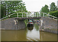
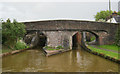
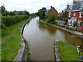
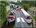
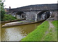
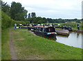
Photos of CW11 0GB
Area Information
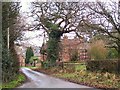
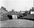
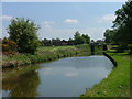
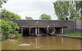
CW11 0GB is a small, rural postcode area in Cheshire East, encompassing parts of Betchton, Hassall Green, and Malkin’s Bank. With a population of 1494 and a density of 92 people per square kilometre, it reflects a quiet, low-density residential cluster. The area retains historical roots, including Betchton Hall—a 18th-century estate—and the Tin Tabernacle, a unique 1880s corrugated iron church. Its proximity to Sandbach and the M6 motorway offers access to regional amenities without sacrificing rural character. Daily life here is defined by a close-knit community, with a strong emphasis on local heritage. The area’s low crime risk—scoring 96/100—and negligible flood or environmental constraints make it appealing for those seeking safety and stability. While small, CW11 0GB is well-connected to nearby towns via rail stations and major roads, blending practicality with a sense of place.
- Area Type
- Postcode
- Area Size
- Not available
- Population
- 1494
- Population Density
- 92 people/km²
CW11 0GB is predominantly an owner-occupied area, with 80% of homes owned by residents rather than rented. The accommodation type is primarily houses, which is unusual for a small postcode area but suggests a mix of larger, standalone properties. This contrasts with areas dominated by flats or apartments, indicating a focus on traditional, family-friendly housing. The limited number of properties means the market is likely niche, with fewer options for buyers. However, the high home ownership rate and low crime risk may make it attractive to those prioritising security and long-term investment. Prospective buyers should consider the area’s small size and proximity to Sandbach for broader property choices.
House Prices in CW11 0GB
No properties found in this postcode.
Energy Efficiency in CW11 0GB
The lifestyle in CW11 0GB is shaped by its rural setting and nearby amenities. Retail options include Co-op The, Waitrose Sandbach, and Iceland Sandbach, offering grocery and convenience shopping. The area’s character is defined by historical sites like Betchton Hall and the Tin Tabernacle, alongside practical transport links to rail stations. While the postcode area is small, its proximity to Sandbach and the M6 motorway ensures residents can access larger towns for leisure, dining, and services. The mix of local shops and transport connectivity supports a balanced lifestyle, combining rural tranquillity with regional accessibility.
Amenities
Schools
The nearest school to CW11 0GB is Hassall Green Methodist Primary School, a primary education institution serving the local community. No secondary schools are listed in the data, meaning families may need to look to nearby towns like Sandbach for secondary education. The presence of a primary school suggests the area is suitable for young children, though the absence of detailed Ofsted ratings means its quality cannot be assessed here. For families prioritising proximity to schools, the primary institution is a key asset, but secondary schooling options may require commuting.
| Rank | School | Type | Entry gender | Ages |
|---|
Explore more schools in this area
Go to Schools tabDemographics
The population of CW11 0GB skews towards adults aged 30–64, with a median age of 47. This suggests a mature, established community, likely with families and long-term residents. Home ownership is high at 80%, with houses being the predominant accommodation type. The majority of residents identify as White, reflecting the area’s demographic profile. While no specific data on deprivation is provided, the high home ownership rate and low crime score imply a stable, low-risk environment. The absence of detailed diversity statistics means the community’s composition remains largely homogenous. For buyers, this indicates a neighbourhood where property values are likely to remain steady, and the demographic profile aligns with those seeking a settled, family-oriented lifestyle.
Household Size
Accommodation Type
Tenure
Ethnic Group
Religion
Household Composition
Age
Household Deprivation
NS-SEC
Explore more demographic insights in this area
Go to Demographics tabPlanning
Planning Constraints
- Flood RiskPremium
- Ramsar Wetland SitesPremium
- Area of Outstanding Natural BeautyPremium
- Protected Nature ReservePremium
- Protected WoodlandPremium