Area Overview for CW10 9AT
Photos of CW10 9AT


Area Information
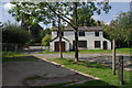
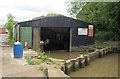
CW10 9AT is a small residential postcode nestled in the Cheshire East district, encompassing parts of the historic market town of Middlewich. With a population of 1,493, this area reflects the character of a traditional English town, shaped by its rivers, canals, and historical significance. Middlewich, once a Roman salt-producing hub, remains a place of quiet charm, with its rivers—the Dane, Croco, Wheelock, and Weaver—intersecting with the Shropshire Union and Trent and Mersey canals. The area is accessible via major roads like the A533, A54, and A530, and within reach of several railway stations, including Winsford, Sandbach, and Holmes Chapel. Daily life here is defined by a blend of heritage and practicality, with residents enjoying proximity to retail hubs, historical landmarks, and a low crime rate. The postcode’s compact size means it is ideal for those seeking a close-knit community with easy access to both rural tranquillity and regional connectivity.
- Area Type
- Postcode
- Area Size
- Not available
- Population
- 1493
- Population Density
- 4473 people/km²
The property market in CW10 9AT is dominated by owner-occupied homes, with 68% of residents owning their properties. The area’s housing stock is primarily composed of houses, rather than apartments or flats, which is typical of smaller rural and semi-rural postcodes. This suggests a community focused on family homes and long-term residency rather than transient rental markets. The limited size of the postcode means the housing stock is not extensive, but the presence of nearby towns like Middlewich may offer additional options for buyers seeking larger properties or alternative styles. For those considering purchase, the area’s low crime rate and historical character could be appealing, though the market may be niche due to its small scale.
House Prices in CW10 9AT
No properties found in this postcode.
Energy Efficiency in CW10 9AT
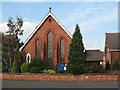
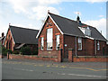
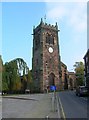
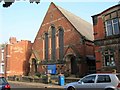
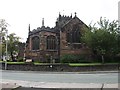
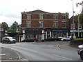
Living in CW10 9AT offers access to a mix of practical amenities and historical charm. Within practical reach are retail outlets such as Tesco Middlewich, Lidl Middlewich, and Morrisons Middlewich, ensuring daily shopping needs are met. The area’s proximity to canals and rivers adds to its appeal, with heritage sites like the parish church of St. Michael and All Angels providing a sense of local history. The town’s canals and rivers also host events and festivals, contributing to a community-focused lifestyle. While specific details on dining or leisure facilities are not provided, the presence of nearby rail stations and roads suggests easy access to broader regional amenities. The combination of retail, transport, and historical features creates a balanced lifestyle for residents.
Amenities
Schools
| Rank | School | Type | Entry gender | Ages |
|---|
Explore more schools in this area
Go to Schools tabDemographics
The population of CW10 9AT is predominantly middle-aged, with a median age of 47 and the most common age range being adults aged 30–64. This suggests a stable, mature community with a focus on established households. Home ownership is strong, with 68% of residents owning their homes, indicating a sense of permanence. The area is characterised by houses rather than flats, reflecting a traditional housing stock. The predominant ethnic group is White, which aligns with broader trends in rural Cheshire. The absence of specific deprivation data means no direct commentary on economic hardship, but the high home ownership rate and age profile suggest a relatively secure and self-sufficient demographic.
Household Size
Accommodation Type
Tenure
Ethnic Group
Religion
Household Composition
Age
Household Deprivation
NS-SEC
Explore more demographic insights in this area
Go to Demographics tabPlanning
Planning Constraints
- Flood RiskPremium
- Ramsar Wetland SitesPremium
- Area of Outstanding Natural BeautyPremium
- Protected Nature ReservePremium
- Protected WoodlandPremium