Area Overview for CW10 0PF
Photos of CW10 0PF
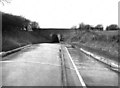
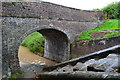
![Stanthorne Bridge [No 27] from Stanthorne Lock in CW10 0PF](https://images.propbar.co.uk/images/geograph/51/94/5194624_120.jpg)
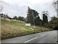
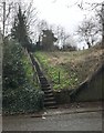
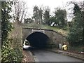
40 photos from this area
Area Information
Key information about the CW10 0PF including its size, population, and administrative classification.
- Area Type
- Postcode
- Area Size
- 4303 m²
- Population
- 1215
- Population Density
- 1684 people/km²
House Prices in CW10 0PF
10
Properties
£194,438
Average Sold Price
£78,500
Lowest Price
£297,500
Highest Price
Showing 10 properties
| Address | Type | Beds | Baths | Last Sale Price | Last Sale Date | |
|---|---|---|---|---|---|---|
| 6 Bradley Close, Middlewich, CW10 0PF | house | - | - | £297,500 | Sep 2019 | |
| 2 Bradley Close, Middlewich, CW10 0PF | house | - | - | £200,000 | Dec 2018 | |
| 8 Bradley Close, Middlewich, CW10 0PF | Detached | 4 | 2 | £255,000 | Aug 2017 | |
| 4 Bradley Close, Middlewich, CW10 0PF | house | - | - | £158,000 | Oct 2015 | |
| 7 Bradley Close, Middlewich, CW10 0PF | house | - | - | £194,500 | Dec 2014 | |
| 9 Bradley Close, Middlewich, CW10 0PF | house | - | - | £182,000 | May 2012 | |
| 1 Bradley Close, Middlewich, CW10 0PF | Detached | 3 | - | £190,000 | Feb 2009 | |
| 5 Bradley Close, Middlewich, CW10 0PF | Detached | - | - | £78,500 | Sep 2000 | |
| 3 Bradley Close, Middlewich, CW10 0PF | Detached | - | - | - | - | |
| 10 Bradley Close, Middlewich, CW10 0PF | Detached | - | - | - | - |
Energy Efficiency in CW10 0PF
Amenities
Schools
| Rank | School | Type | Entry gender | Ages |
|---|
Explore more schools in this area
Go to Schools tabDemographics
Household Size
Two person
most common
Accommodation Type
Houses
most common
Tenure
92
majority
Ethnic Group
White
most common
Religion
N/A
most common
Household Composition
N/A
most common
Age
47
median
Adults (30-64 years)
most common
Household Deprivation
N/A
with no deprivation
NS-SEC
39
in Lower managerial occupations
Explore more demographic insights in this area
Go to Demographics tabPlanning
Planning Constraints
- Flood RiskPremium
- Ramsar Wetland SitesPremium
- Area of Outstanding Natural BeautyPremium
- Protected Nature ReservePremium
- Protected WoodlandPremium