Area Overview for CW1 6YA
Photos of CW1 6YA
Area Information
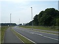
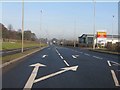
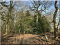
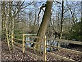
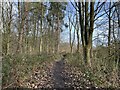
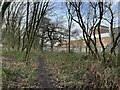
Living in CW1 6YA means inhabiting a compact, residential cluster in Cheshire East, just east of Crewe town centre. The area covers 3.5 hectares and is home to 1,426 people, translating to a high population density of 944 people per square kilometre. This small postcode area blends suburban tranquillity with proximity to urban amenities. Historically part of Crewe Green, a village with roots in the 12th century, the area now includes dispersed housing, farms, and industrial estates like Crewe Hall Enterprise Park. Residents benefit from nearby attractions such as the grade-I-listed Crewe Hall and 201 hectares of parkland. Daily life here is shaped by its small-scale character, with easy access to Crewe’s town centre, rail networks, and local retail. The mix of homes, farms, and light industry creates a distinct microcosm, where community ties are likely strong, and the pace of life remains measured compared to larger cities.
- Area Type
- Postcode
- Area Size
- 3.5 hectares
- Population
- 1426
- Population Density
- 944 people/km²
The property market in CW1 6YA is characterised by high home ownership (87%) and a focus on houses rather than flats. This suggests a market skewed towards owner-occupied properties, likely catering to families or individuals seeking more space. The small area size and limited housing stock mean the market is unlikely to be highly competitive, but buyers should consider the proximity to Crewe’s urban amenities and the area’s blend of residential and industrial land use. The predominance of houses may appeal to those prioritising privacy and space, though the lack of rental properties indicates a lower turnover rate. For buyers, this means a potential focus on long-term value rather than speculative investment, with properties likely retaining their appeal due to the area’s stability and connectivity.
House Prices in CW1 6YA
No properties found in this postcode.
Energy Efficiency in CW1 6YA
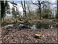
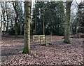
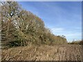
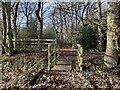
Daily life in CW1 6YA is enriched by nearby amenities, including five retail outlets such as Co-op Gateway, Aldi University, and Tesco Crewe. These shops provide essentials, while the rail network connects residents to broader leisure and employment opportunities. The area’s proximity to Crewe Hall and its 201 hectares of parkland offers green spaces for walking, picnics, or outdoor activities. The Crewe and Nantwich Circular Walk provides scenic routes, and historical sites like St Michael and All Angels Church add cultural value. With a mix of retail, transport, and natural spaces, the area supports both practical needs and a relaxed lifestyle, appealing to those seeking convenience without urban chaos.
Amenities
Schools
The schools closest to CW1 6YA include Springfield School and Safe Opportunities, both designated as special schools. These institutions cater to students with specific educational needs, reflecting the area’s role in supporting families requiring tailored learning environments. The presence of two special schools suggests a focus on inclusivity and accessibility for children with additional needs. While no Ofsted ratings are provided, the types of schools available indicate that families in the area may prioritise support services for children with disabilities or learning differences. This mix of school types ensures that residents have access to dedicated resources, though parents should consider whether these options align with their children’s requirements.
| Rank | School | Type | Entry gender | Ages |
|---|
Explore more schools in this area
Go to Schools tabDemographics
CW1 6YA has a median age of 47, with the majority of residents aged 30–64. This suggests a community of established adults, many of whom may be in their prime working years or nearing retirement. Home ownership is high at 87%, indicating a stable, long-term resident base. The area is predominantly composed of houses, not flats, which aligns with the demographic profile of older, family-oriented households. The predominant ethnic group is White, reflecting the broader patterns of Cheshire East. With a population of 1,426, the area is small enough to foster a close-knit community but large enough to support essential services. The age distribution and ownership rates imply a mature, settled population, which may influence local amenities and social dynamics.
Household Size
Accommodation Type
Tenure
Ethnic Group
Religion
Household Composition
Age
Household Deprivation
NS-SEC
Explore more demographic insights in this area
Go to Demographics tabPlanning
Planning Constraints
- Flood RiskPremium
- Ramsar Wetland SitesPremium
- Area of Outstanding Natural BeautyPremium
- Protected Nature ReservePremium
- Protected WoodlandPremium