Area Overview for CW1 6WJ
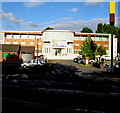
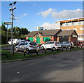
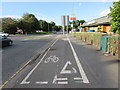
Photos of CW1 6WJ


Area Information
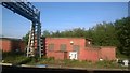
CW1 6WJ is a small residential postcode area in Cheshire East, England, encompassing a cluster of homes and industrial estates near Crewe town centre. With a population of 1,516 and a density of 1,072 people per square kilometre, it reflects a compact, tightly knit community. The area’s history is rooted in its medieval origins as part of the de Crewe family’s estate, with remnants like the grade-I-listed Crewe Hall and its surrounding parkland still visible today. Modern life here blends suburban living with proximity to Crewe’s town centre, offering access to retail, transport, and employment hubs. The postcode includes dispersed housing, farms, and industrial sites such as Crewe Hall Enterprise Park, catering to both residential and commercial needs. Residents benefit from nearby rail links, including Crewe and Nantwich stations, and a network of local roads and footpaths. While the area’s small size means limited housing stock, its strategic location and historical character make it appealing to those seeking a balance between rural charm and urban connectivity.
- Area Type
- Postcode
- Area Size
- Not available
- Population
- 1516
- Population Density
- 1072 people/km²
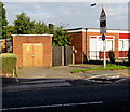
The property market in CW1 6WJ is primarily owner-occupied, with 69% of homes owned by residents rather than rented. This suggests a stable, long-term demographic and limited turnover in the housing stock. The area is dominated by houses, which are more common than flats or apartments, indicating a focus on family homes and traditional residential living. Given the small size of the postcode area, the housing stock is likely limited, meaning buyers may need to consider nearby areas for more options. The presence of industrial estates like Crewe Hall Enterprise Park suggests a mix of residential and commercial properties, though the primary accommodation type remains houses. For buyers, this means a focus on family-friendly homes in a semi-rural setting, with potential for growth in nearby towns like Crewe.
House Prices in CW1 6WJ
No properties found in this postcode.
Energy Efficiency in CW1 6WJ
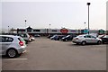
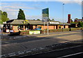
The lifestyle in CW1 6WJ is shaped by its proximity to Crewe’s amenities and the presence of local retail options. Nearby shops include Tesco Crewe, Iceland Crewe, and Lidl Dorothy, offering everyday essentials within easy reach. The area’s rail links to Crewe, Nantwich, and Sandbach stations provide access to larger towns for dining, entertainment, and leisure. For outdoor activities, the Crewe and Nantwich Circular Walk offers a scenic route through the surrounding landscape. The historical sites of Crewe Hall and its parkland add cultural value, though the area itself is more residential than tourist-focused. Residents benefit from a mix of convenience and tranquility, with local shops and transport links balancing the semi-rural setting. The compact nature of the postcode means amenities are concentrated, requiring minimal travel for daily needs.
Amenities
Schools
Residents of CW1 6WJ have access to three primary schools within practical reach: Hungerford Primary School and two iterations of Hungerford Primary Academy, one of which holds an Ofsted rating of ‘satisfactory’. These schools cater to younger children, providing a foundation for local education. The presence of multiple primary schools indicates a focus on early education, though the ‘satisfactory’ rating for one academy suggests room for improvement in standards. Families with young children may benefit from the proximity of these schools, though the lack of secondary schools in the immediate area could necessitate travel to Crewe or nearby towns. The concentration of primary education options supports a community-oriented approach to schooling, but buyers should consider the broader educational landscape when evaluating the area.
| Rank | School | Type | Entry gender | Ages |
|---|
Explore more schools in this area
Go to Schools tabDemographics
The population of CW1 6WJ is predominantly middle-aged, with a median age of 47 and the most common age range being adults aged 30–64. This suggests a community of established residents, many of whom may be homeowners, as 69% of households own their homes. The area is characterised by a high proportion of houses, reflecting a more traditional, family-oriented housing stock. The predominant ethnic group is White, indicating a homogenous demographic profile. While no specific data on deprivation is provided, the age and ownership statistics imply a stable, low-turnover community. The absence of significant diversity data means the area’s social fabric is largely shaped by long-term residents. This profile may appeal to those seeking a quiet, settled environment, though it also means the population is less likely to include younger families or transient workers.
Household Size
Accommodation Type
Tenure
Ethnic Group
Religion
Household Composition
Age
Household Deprivation
NS-SEC
Explore more demographic insights in this area
Go to Demographics tabPlanning
Planning Constraints
- Flood RiskPremium
- Ramsar Wetland SitesPremium
- Area of Outstanding Natural BeautyPremium
- Protected Nature ReservePremium
- Protected WoodlandPremium