Area Overview for CW1 6FG
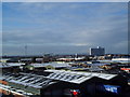
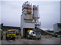
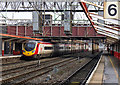
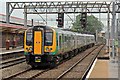
Photos of CW1 6FG


Area Information
Living in CW1 6FG means being part of a small, tightly knit residential cluster in Cheshire East, just 1½ miles east of Crewe town centre. The area, historically known as Crewe Green, is characterised by a mix of dispersed houses, farms, and industrial estates like Crewe Hall Enterprise Park. With a population of 1,516 and a density of 1,072 people per square kilometre, it is a compact community where daily life is shaped by proximity to Crewe’s amenities and the surrounding countryside. The area’s history as a former civil parish, renamed in 1984 to avoid confusion with Crewe town, adds a layer of local identity. Residents benefit from nearby landmarks such as the grade-I-listed Crewe Hall and 201 hectares of parkland, offering both historical interest and green space. The blend of rural and suburban elements makes CW1 6FG appealing to those seeking a balance between town and country living, with easy access to Crewe’s transport networks and retail hubs.
- Area Type
- Postcode
- Area Size
- Not available
- Population
- 1516
- Population Density
- 1072 people/km²
The property market in CW1 6FG is defined by its high home ownership rate (69%) and a focus on houses rather than flats. This suggests a market skewed towards owner-occupied properties, with limited rental activity. The area’s small size means the housing stock is concentrated, offering buyers a limited but distinct range of options. The presence of industrial estates like Crewe Hall Enterprise Park may influence property values, with homes in proximity to such sites potentially benefiting from employment opportunities. However, the compact nature of the area means buyers must consider nearby towns like Crewe for broader housing choices. For those prioritising traditional family homes, CW1 6FG’s predominantly single-family housing stock may be appealing, though its small size could limit availability.
House Prices in CW1 6FG
No properties found in this postcode.
Energy Efficiency in CW1 6FG
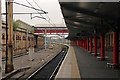
Residents of CW1 6FG enjoy a range of nearby amenities, including five retail outlets such as Tesco Crewe, Co-op Gateway, and Lidl Dorothy, offering everyday shopping convenience. The area’s rail connectivity to Crewe, Nantwich, and Sandbach stations provides access to broader leisure and employment opportunities. Locally, the historical and natural features of Crewe Hall, its parkland, and the Crewe and Nantwich Circular Walk add to the area’s charm. While the data does not list specific parks or leisure facilities, the presence of 201 hectares of grade II-listed gardens and woodlands suggests opportunities for outdoor activities. The combination of retail, transport, and green spaces creates a lifestyle that blends practicality with a touch of historical significance, ideal for those seeking a balanced, community-oriented environment.
Amenities
Schools
Residents of CW1 6FG have access to three primary schools within practical reach: Hungerford Primary School, Hungerford Primary Academy, and another instance of Hungerford Primary Academy with an Ofsted rating of ‘satisfactory’. While no secondary schools are listed in the data, the concentration of primary options suggests the area is well-served for younger children. The duplication of school names may indicate multiple campuses or a mix of independent and state-run institutions. For families requiring primary education, the availability of three schools offers choice, though the ‘satisfactory’ rating for one school highlights the need for careful evaluation of educational quality. The absence of secondary schools means parents may need to consider commuting to nearby towns like Crewe for secondary education.
| Rank | School | Type | Entry gender | Ages |
|---|
Explore more schools in this area
Go to Schools tabDemographics
CW1 6FG has a median age of 47, with the majority of residents aged between 30 and 64. This suggests a community of established professionals and families, rather than a younger or elderly demographic. Home ownership is high at 69%, indicating a stable, long-term resident base. The area is predominantly composed of houses, not flats, which aligns with the typical housing stock of small rural clusters. The predominant ethnic group is White, reflecting broader regional trends in Cheshire. While no specific data on deprivation is provided, the high home ownership rate and age profile imply a community with relatively stable economic conditions. However, the absence of detailed diversity metrics means the full scope of social composition remains unexplored.
Household Size
Accommodation Type
Tenure
Ethnic Group
Religion
Household Composition
Age
Household Deprivation
NS-SEC
Explore more demographic insights in this area
Go to Demographics tabPlanning
Planning Constraints
- Flood RiskPremium
- Ramsar Wetland SitesPremium
- Area of Outstanding Natural BeautyPremium
- Protected Nature ReservePremium
- Protected WoodlandPremium