Area Overview for CW1 4SB
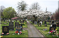
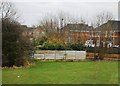
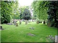
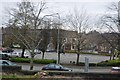
Photos of CW1 4SB
Area Information
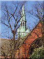
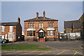
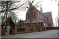
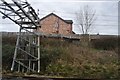
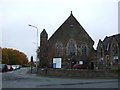
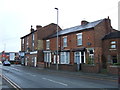
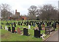
Living in CW1 4SB means being part of a compact, residential cluster in the heart of Crewe Green, a village now integrated into Weston and Crewe Green. With a population of 2,356 and a density of 1,126 people per square kilometre, this area balances small-community charm with proximity to Crewe town. Historically rooted, it was once a civil parish linked to the de Crewe family and features landmarks like St Michael and All Angels Church and the grade-I-listed Crewe Hall. The area includes farms, industrial estates, and green spaces such as Rookery Wood. Daily life here is shaped by its mix of residential and light industrial use, with easy access to rail networks and local amenities. The compact layout ensures a tight-knit feel, while nearby Crewe offers larger-town conveniences. For those seeking a quiet, historically rich setting with practical connectivity, CW1 4SB offers a distinct blend of tradition and modernity.
- Area Type
- Postcode
- Area Size
- Not available
- Population
- 2356
- Population Density
- 1126 people/km²
The property market in CW1 4SB is characterised by high home ownership (75%) and a focus on houses rather than flats or apartments. This suggests a predominantly owner-occupied area with limited rental stock, likely appealing to buyers seeking stability and long-term investment. The concentration of houses reflects a suburban or semi-rural layout, possibly with larger gardens or plots, typical of areas near industrial estates or historic sites. Given the small size of the postcode, the housing stock may be limited, but the proximity to Crewe and its infrastructure could enhance property value. Buyers should consider the area’s compact nature and the mix of residential and light industrial land use, which may influence future development or neighbourly dynamics. The market appears to cater to those prioritising ownership over rental flexibility, with a focus on established, family-friendly homes.
House Prices in CW1 4SB
No properties found in this postcode.
Energy Efficiency in CW1 4SB
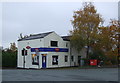
Residents of CW1 4SB have access to a range of amenities within practical reach, including retail options like Co-op Crewe, Morrisons Daily Crewe Ridgeway Street, and other local stores. The area’s proximity to Crewe and its industrial estates, such as Crewe Hall Enterprise Park, may offer employment opportunities, though the primary focus remains on residential living. Green spaces like Rookery Wood and Temple of Peace Wood, both grade II-listed, provide leisure and recreational value. The presence of historic sites, including St Michael and All Angels Church and Crewe Hall, adds cultural depth. While the area lacks large-scale leisure facilities, its compact layout ensures convenience, with shops, transport, and natural spaces all within walking or short driving distance. This blend of practicality and heritage supports a lifestyle that balances everyday needs with historical and environmental enrichment.
Amenities
Schools
Nearby schools include Focus School - Crewe Primary Campus, an independent institution, and Cornerstone Academy, which also holds an Ofsted rating of 'good'. Oakfield Lodge School is listed twice, though its type is categorised as 'other'. The mix of independent and other schools offers families a range of educational options, from private institutions to state-funded alternatives. Independent schools like Focus School and Cornerstone Academy may provide structured curricula and facilities, while Oakfield Lodge’s unspecified type could indicate a specialist or alternative provision. This diversity allows parents to choose between traditional schooling and potentially niche educational approaches. The presence of a 'good' Ofsted-rated school suggests at least one institution meets high standards, though the overall quality of the area’s schools would depend on individual preferences and needs.
| Rank | School | Type | Entry gender | Ages |
|---|
Explore more schools in this area
Go to Schools tabDemographics
The community in CW1 4SB has a median age of 47, with the majority of residents aged between 30 and 64. This suggests a population skewed towards adults, likely including families and professionals. Home ownership is high at 75%, indicating a stable, long-term resident base. The accommodation type is predominantly houses, reflecting a suburban or semi-rural character. The predominant ethnic group is White, though no further breakdown of diversity is provided. The age profile and ownership rates imply a mature, settled community with fewer young families or transient populations. The lack of specific data on deprivation means the area’s quality of life is inferred from its infrastructure and amenities, which appear well-maintained. This demographic profile aligns with a quiet, family-oriented environment where property is largely owner-occupied.
Household Size
Accommodation Type
Tenure
Ethnic Group
Religion
Household Composition
Age
Household Deprivation
NS-SEC
Explore more demographic insights in this area
Go to Demographics tabPlanning
Planning Constraints
- Flood RiskPremium
- Ramsar Wetland SitesPremium
- Area of Outstanding Natural BeautyPremium
- Protected Nature ReservePremium
- Protected WoodlandPremium