Area Overview for CW1 4PS
Photos of CW1 4PS
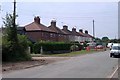
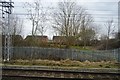
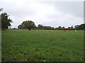
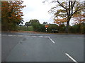
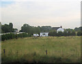
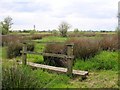
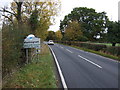

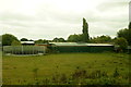
10 photos from this area
Area Information
Key information about the CW1 4PS including its size, population, and administrative classification.
- Area Type
- Postcode
- Area Size
- 7.4 hectares
- Population
- 2356
- Population Density
- 1126 people/km²
House Prices in CW1 4PS
22
Properties
£153,073
Average Sold Price
£17,000
Lowest Price
£250,000
Highest Price
Showing 22 properties
| Address | Type | Beds | Baths | Last Sale Price | Last Sale Date | |
|---|---|---|---|---|---|---|
| 116 Warmingham Road, Crewe, CW1 4PS | Semi-detached | 3 | 1 | £215,000 | Nov 2025 | |
| 85 Warmingham Road, Crewe, CW1 4PS | house | - | - | £250,000 | Jul 2020 | |
| 81 Warmingham Road, Crewe, CW1 4PS | house | - | - | £195,000 | Mar 2020 | |
| 108 Warmingham Road, Crewe, CW1 4PS | Semi-detached | 3 | 2 | £147,000 | Oct 2018 | |
| 98 Warmingham Road, Crewe, CW1 4PS | house | 3 | - | £220,000 | Aug 2016 | |
| 91A Warmingham Road, Crewe, CW1 4PS | Detached | 2 | 1 | £195,000 | Jul 2016 | |
| 83 Warmingham Road, Crewe, CW1 4PS | Semi-detached | 2 | 1 | £110,000 | Oct 2015 | |
| 114 Warmingham Road, Crewe, CW1 4PS | Semi-detached | 3 | - | £110,000 | May 2013 | |
| 89 Warmingham Road, Crewe, CW1 4PS | Detached | - | - | £220,000 | Jul 2003 | |
| 112 Warmingham Road, Crewe, CW1 4PS | Semi-detached | - | - | £79,950 | Dec 2002 |
Page 1 of 3
Energy Efficiency in CW1 4PS
Amenities
Schools
| Rank | School | Type | Entry gender | Ages |
|---|
Explore more schools in this area
Go to Schools tabDemographics
Household Size
Two person
most common
Accommodation Type
Houses
most common
Tenure
75
majority
Ethnic Group
White
most common
Religion
N/A
most common
Household Composition
N/A
most common
Age
47
median
Adults (30-64 years)
most common
Household Deprivation
N/A
with no deprivation
NS-SEC
30
in Lower managerial occupations
Explore more demographic insights in this area
Go to Demographics tabPlanning
Planning Constraints
- Flood RiskPremium
- Ramsar Wetland SitesPremium
- Area of Outstanding Natural BeautyPremium
- Protected Nature ReservePremium
- Protected WoodlandPremium