Area Overview for CW1 4GQ
Photos of CW1 4GQ
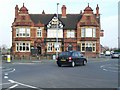


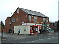


12 photos from this area
Area Information
Key information about the CW1 4GQ including its size, population, and administrative classification.
- Area Type
- Postcode
- Area Size
- 8854 m²
- Population
- 2356
- Population Density
- 1126 people/km²
House Prices in CW1 4GQ
31
Properties
£164,265
Average Sold Price
£132,995
Lowest Price
£222,995
Highest Price
Showing 31 properties
| Address | Type | Beds | Baths | Last Sale Price | Last Sale Date | |
|---|---|---|---|---|---|---|
| 34 Wilding Drive, Crewe, CW1 4GQ | Detached | 2 | 1 | £165,000 | Sep 2025 | |
| 20 Wilding Drive, Crewe, CW1 4GQ | house | - | - | £220,000 | Jul 2024 | |
| 16 Wilding Drive, Crewe, CW1 4GQ | Terraced | 2 | 2 | £162,000 | Jun 2024 | |
| 36 Wilding Drive, Crewe, CW1 4GQ | Terraced | 2 | - | £155,500 | Apr 2023 | |
| 4 Wilding Drive, Crewe, CW1 4GQ | Semi-detached | 3 | 2 | £171,000 | Feb 2022 | |
| 2 Wilding Drive, Crewe, CW1 4GQ | Semi-detached | 2 | 1 | £181,000 | Sep 2021 | |
| 10 Wilding Drive, Crewe, CW1 4GQ | Terraced | 2 | 1 | £142,000 | Jul 2021 | |
| 52 Wilding Drive, Crewe, CW1 4GQ | Semi-detached | 2 | 1 | £136,000 | Jul 2021 | |
| 38 Wilding Drive, Crewe, CW1 4GQ | Terraced | 2 | 1 | £140,000 | Jun 2020 | |
| 60 Wilding Drive, Crewe, CW1 4GQ | Bungalow | - | - | £139,500 | May 2018 |
Page 1 of 4
Energy Efficiency in CW1 4GQ
Amenities
Schools
| Rank | School | Type | Entry gender | Ages |
|---|
Explore more schools in this area
Go to Schools tabDemographics
Household Size
Two person
most common
Accommodation Type
Houses
most common
Tenure
75
majority
Ethnic Group
White
most common
Religion
N/A
most common
Household Composition
N/A
most common
Age
47
median
Adults (30-64 years)
most common
Household Deprivation
N/A
with no deprivation
NS-SEC
30
in Lower managerial occupations
Explore more demographic insights in this area
Go to Demographics tabPlanning
Planning Constraints
- Flood RiskPremium
- Ramsar Wetland SitesPremium
- Area of Outstanding Natural BeautyPremium
- Protected Nature ReservePremium
- Protected WoodlandPremium