Area Overview for CW1 3YZ
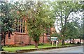
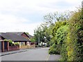
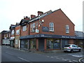
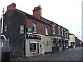
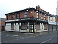
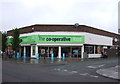
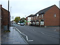
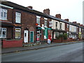
Photos of CW1 3YZ


Area Information
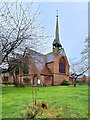
CW1 3YZ is a small residential postcode area in Cheshire East, encompassing the village of Crewe Green. With a population of 1,500, it is a quiet, low-density cluster of homes, farms, and industrial estates. Historically part of the de Crewe family’s estate, the area is now a civil parish within Weston and Crewe Green. Its character is defined by rural landscapes, including 201 hectares of listed parkland and the grade-I-listed Crewe Hall, which now operates as a hotel and restaurant. The area is 1.5 miles east of Crewe town centre, offering proximity to urban amenities while retaining a village feel. Residents benefit from nearby rail links, including Crewe, Sandbach, and Nantwich stations, and a network of walking trails. The mix of homes, farms, and green spaces creates a distinctive blend of historical charm and practical living, ideal for those seeking a peaceful yet connected lifestyle.
- Area Type
- Postcode
- Area Size
- Not available
- Population
- 1500
- Population Density
- 4783 people/km²
The property market in CW1 3YZ is dominated by owner-occupied homes, with 60% of residents owning their properties. The accommodation type is exclusively houses, reflecting a preference for larger, family-friendly homes. This contrasts with areas dominated by flats or rental properties, suggesting a community prioritising stability and space. Given the small size of the postcode area, the housing stock is limited, with no indication of high-rise developments or new builds. Buyers should consider the competitive nature of the market, as demand for owner-occupied homes in this rural setting may outstrip supply. The presence of industrial estates like Crewe Hall Enterprise Park nearby hints at potential for mixed-use development, but current listings are likely focused on residential properties. For buyers, this area offers a rare combination of historical charm and practical housing, though availability may be constrained by its small footprint.
House Prices in CW1 3YZ
No properties found in this postcode.
Energy Efficiency in CW1 3YZ
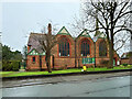
The lifestyle in CW1 3YZ is shaped by its proximity to retail and transport hubs. Nearby shops include Morrisons Daily and Asda Crewe, offering essential groceries and services within practical reach. The area’s rail stations connect residents to larger towns, enabling access to more extensive shopping, dining, and leisure options. While the postcode itself lacks major leisure facilities, its rural setting includes green spaces like Rookery Wood and Temple of Peace Wood, which are part of the area’s historical parkland. These spaces provide opportunities for walking, cycling, and outdoor activities. The blend of local retail, accessible transport, and natural landscapes supports a balanced lifestyle, combining convenience with the tranquillity of a semi-rural location.
Amenities
Schools
The nearest school to CW1 3YZ is Church Coppenhall Junior School, a primary school serving the local community. While no Ofsted rating is provided, its presence indicates a focus on early education for families in the area. The absence of secondary schools within the postcode means parents may need to look further afield, such as Crewe or Nantwich, for comprehensive schooling. This could be a consideration for families requiring a full range of educational options. However, the proximity of primary schools to homes in CW1 3YZ supports a community-oriented approach to education, reducing commute times for younger children. The single school listed reflects the area’s small size and the need for regional coordination in secondary education planning.
| Rank | School | Type | Entry gender | Ages |
|---|
Explore more schools in this area
Go to Schools tabDemographics
The population of CW1 3YZ is predominantly adults aged 30–64, with a median age of 47. This suggests a mature community, likely with established families and professionals. Home ownership is strong, with 60% of residents owning their homes, and the accommodation type is primarily houses, indicating a focus on family-friendly housing. The predominant ethnic group is White, reflecting the area’s historical roots and limited demographic diversity. While no specific deprivation data is provided, the age profile and home ownership suggest a stable, middle-income community. The absence of younger households or high rental rates implies a focus on long-term residency rather than transient populations. This profile aligns with the area’s rural character and proximity to larger towns, offering a balance of local amenities and regional opportunities.
Household Size
Accommodation Type
Tenure
Ethnic Group
Religion
Household Composition
Age
Household Deprivation
NS-SEC
Explore more demographic insights in this area
Go to Demographics tabPlanning
Planning Constraints
- Flood RiskPremium
- Ramsar Wetland SitesPremium
- Area of Outstanding Natural BeautyPremium
- Protected Nature ReservePremium
- Protected WoodlandPremium