Area Overview for CW1 3HB
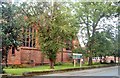
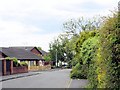
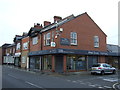
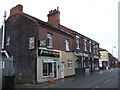
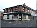
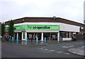
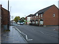
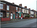
Photos of CW1 3HB
Area Information
Living in CW1 3HB means residing within a specific postcode area that covers a small residential cluster in the East Cheshire district. This location encompasses 2,147 square metres and serves a population of 2,333 residents. The area is situated in the unitary authority of Cheshire East, approximately 1½ miles east of the main town centre of Crewe. Historically, this site was known as Crewe Green and functioned as a separate civil parish until April 2023, when it became part of the combined parish of Weston and Crewe Green. The neighbourhood currently features dispersed housing alongside industrial elements such as the Crewe Hall Enterprise Park and Crewe Hall Farm. You will find remnants of local history in the form of the former Crewe Hall mansion, which now operates as a hotel and restaurant. The landscape is defined by the east-west flow of the B5077 road and the Crewe-Alsager railway line, while watercourses like Valley Brook and Englesea Brook cut through the terrain. Living here offers proximity to the St Michael and All Angels Church and the historic Temple of Peace Wood without being deep in the urban sprawl of Crewe.
- Area Type
- Postcode
- Area Size
- 2147 m²
- Population
- 2333
- Population Density
- 6693 people/km²
The property market in CW1 3HB is characterised by a heavy reliance on detached or semi-detached houses, as the accommodation type data specifies Houses as the sole category. Only 31% of residents are homeowners, which indicates that the majority of the housing stock consists of rental properties. This suggests you will find more tenanted homes than owner-occupied ones when viewing properties in this postcode cluster. The total area measures just 2,147 square metres holding 2,333 people, meaning the housing supply is extremely limited for a residential cluster of this size. Given the historical background of Crewe Green as a former civil parish with dispersed housing, the stock likely includes older period properties mixed with modern extensions near the Crewe Hall Enterprise Park. Buyers should be prepared for a competitive market where available inventory is scarce. The high percentage of renters may also indicate an area attractive to professionals working nearby who prefer flexibility over ownership. With specific data limiting the types of homes, the market leans heavily towards traditional family residences situated near the B5077 road or local walks.
House Prices in CW1 3HB
No properties found in this postcode.
Energy Efficiency in CW1 3HB
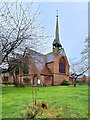
Your daily life in CW1 3HB revolves around convenient access to essential retail and rail hubs nearby. For shopping, you have five major retailers within practical reach, specifically Morrisons Daily, Morrisons Crewe, and Asda Crewe. These supermarkets are the notable anchorage points for your weekly shop, ensuring you do not need to travel far for groceries. Rail access is equally strong, with three railway stations serving the area: Crewe Railway Station, Nantwich Railway Station, and Sandbach Railway Station. The Crewe Railway Station is particularly relevant given its location adjacent to the postcode. The area's notable features include St Michael and All Angels Church in Crewe Green and the expansive 201-hectare grade II-listed parkland containing Rookery Wood and Temple of Peace Wood. The grade-I-listed Jacobean mansion, Crewe Hall, now serves as a hotel and restaurant nearby. You can utilise the Crewe and Nantwich Circular Walk for daily exercise. This blend of village history and modern retail convenience defines the lifestyle here.
Amenities
Schools
Families living in CW1 3HB have access to a consolidated group of educational institutions under the Underwood West name. You will find Underwood West Nursery and Infant School, Underwood West Junior School, and Underwood West Primary School all located in close proximity. Additionally, the area offers secondary-level education through Underwood West Academy, which holds a good Ofsted rating. This concentration of schools suggests a well-serviced catchment area for local children, eliminating the need to travel far for primary or academy-level education. The presence of both primary and academy provisions usually means a coherent educational pathway is available to your child within the immediate neighbourhood. Schools near CW1 3HB provide a familiar environment for growing families who value stability. The good rating of the academy provides reassurance regarding academic standards for those considering this location for their children's upbringing.
| Rank | School | Type | Entry gender | Ages |
|---|
Explore more schools in this area
Go to Schools tabDemographics
The community profile of CW1 3HB indicates a mature demographic, with a median age of 47 years. The most common age group among residents falls within the 30 to 64-year bracket, suggesting an area dominated by adults and established families rather than young professionals or the elderly. Regarding accommodation type, houses make up the primary housing stock, with no data listed for flats or apartments within this specific postcode. Homeownership stands at 31%, meaning nearly a third of residents own their homes outright or with a mortgage, while the majority likely rent. The predominant ethnic group in the area is White, aligning with broader national patterns for rural and suburban villages in Cheshire. With a population density described as exceptionally high by the metric provided, the area maintains a relatively low population count across its limited footprint. This mix of older adults and a majority of homeowners renting suggests a stable, long-term residents base rather than a transient workforce. Living in CW1 3HB typically means engaging with a quiet, established community where neighbours have likely lived for decades.
Household Size
Accommodation Type
Tenure
Ethnic Group
Religion
Household Composition
Age
Household Deprivation
NS-SEC
Explore more demographic insights in this area
Go to Demographics tabPlanning
Planning Constraints
- Flood RiskPremium
- Ramsar Wetland SitesPremium
- Area of Outstanding Natural BeautyPremium
- Protected Nature ReservePremium
- Protected WoodlandPremium