Area Overview for CW1 2PT
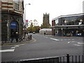
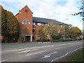
Photos of CW1 2PT
Area Information
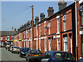
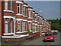
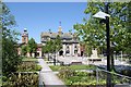
CW1 2PT is a small, densely populated postcode area in Cheshire, England, covering just 1.4 hectares and home to 1,926 residents. It lies within the former village of Crewe Green, now part of Weston and Crewe Green parish. The area blends residential clusters with nearby industrial estates such as Crewe Hall Enterprise Park, offering a mix of urban and semi-rural living. Its proximity to Crewe town centre—just 1½ miles away—provides easy access to services, while historical landmarks like the grade-I-listed Crewe Hall and its surrounding parkland add character. The area’s compact size means a tight-knit community feel, though the high population density of 136,286 people per square kilometre suggests a focus on efficient land use. Living here involves navigating a small-scale environment with a strong local identity, where daily life is shaped by nearby amenities, transport links, and the legacy of its historic roots.
- Area Type
- Postcode
- Area Size
- 1.4 hectares
- Population
- 1926
- Population Density
- 5029 people/km²
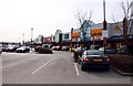
The property market in CW1 2PT is characterised by a low home ownership rate of 21%, indicating that the area functions more as a rental market than an owner-occupied one. The accommodation type is primarily houses, which, given the small area size and high density, likely includes semi-detached or terraced properties. This suggests a housing stock that may be older, with limited new developments. For buyers, this means fewer opportunities for purchase, with most properties available for rent. The compact nature of the postcode also means competition for homes is likely fierce, particularly in the immediate surroundings. Prospective buyers should consider the area’s role as a secondary residential zone, where property values may be lower but demand for rental properties remains steady.
House Prices in CW1 2PT
Showing 1 properties
| Address | Type | Beds | Baths | Last Sale Price | Last Sale Date | |
|---|---|---|---|---|---|---|
| Adsa Pharmacy, 17-18 Victoria Centre, Crewe, CW1 2PT | shop | - | - | - | - |
Energy Efficiency in CW1 2PT
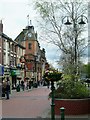
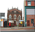
The lifestyle in CW1 2PT is shaped by its proximity to retail and transport hubs. Nearby amenities include Asda Crewe, Morrisons Daily Crewe Ridgeway Street, and Morrisons Crewe, offering everyday shopping convenience. The area’s historical sites, such as Crewe Hall and its grade-II-listed parkland, provide green spaces for leisure. The Crewe and Nantwich Circular Walk offers opportunities for outdoor activity, while the nearby railway stations connect residents to broader networks. The blend of retail, transport, and historical landmarks creates a balanced lifestyle, though the small area size means amenities are concentrated. This compactness can be both a convenience and a limitation, depending on individual preferences.
Amenities
Schools
Nearby schools include Beechwood Primary School and Nursery, which holds a ‘good’ Ofsted rating, and Victoria Community Technology School, a primary institution. The Adelaide School, a special school, is also listed twice, suggesting it serves a specific educational need. The presence of both mainstream and special schools offers families a range of options, though the absence of secondary schools in the immediate area may require travel to Crewe or beyond. The mix of school types reflects the community’s diversity, with a focus on supporting both general and specialist education. For parents, this means access to primary education is strong, but secondary schooling options are limited within the postcode itself.
| Rank | School | Type | Entry gender | Ages |
|---|
Explore more schools in this area
Go to Schools tabDemographics
The population of CW1 2PT skews towards adults aged 30–64, with a median age of 47. This suggests a mature demographic, likely including families and professionals. Home ownership is low at 21%, indicating that the majority of residents are renters, which may reflect the area’s role as a secondary residential hub rather than a primary home market. The accommodation type is predominantly houses, though the high population density implies these are often multi-occupancy or smaller properties. The predominant ethnic group is White, and while specific diversity data is not provided, the age profile and ownership figures suggest a community focused on stability and long-term residency. The low home ownership rate could influence local dynamics, with fewer long-term residents and a higher turnover of tenants.
Household Size
Accommodation Type
Tenure
Ethnic Group
Religion
Household Composition
Age
Household Deprivation
NS-SEC
Explore more demographic insights in this area
Go to Demographics tabPlanning
Planning Constraints
- Flood RiskPremium
- Ramsar Wetland SitesPremium
- Area of Outstanding Natural BeautyPremium
- Protected Nature ReservePremium
- Protected WoodlandPremium