Area Overview for CW1 2NQ
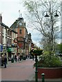
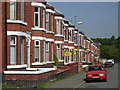
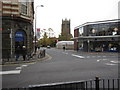
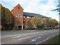
Photos of CW1 2NQ
Area Information
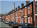
CW1 2NQ, known as Crewe Green, is a small residential cluster in Cheshire East, England, with a population of 1,552. Nestled 1½ miles east of Crewe town centre, it blends historic charm with modern convenience. The area features a mix of dispersed houses, farms, and industrial estates like Crewe Hall Enterprise Park, reflecting its dual role as a rural and semi-urban space. Its history as a former civil parish, renamed in 1984 to avoid confusion with Crewe town, adds to its distinct character. Residents benefit from proximity to Crewe’s amenities while enjoying a quieter, more spread-out living environment. The area’s infrastructure includes the Crewe–Alsager railway line and B5077 road, linking it to nearby towns. With a median age of 47 and a population skewed toward adults aged 30–64, the community is mature and stable, offering a blend of traditional and contemporary lifestyles.
- Area Type
- Postcode
- Area Size
- Not available
- Population
- 1552
- Population Density
- 2124 people/km²
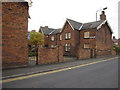
The property market in CW1 2NQ is defined by a 51% home ownership rate, meaning nearly half of the housing stock is rented. The area’s accommodation type is predominantly houses, which are more common than flats or apartments. This suggests a focus on family homes and semi-detached properties, typical of suburban or rural clusters. Given the small size of the postcode and its integration with surrounding industrial estates, the housing stock may be limited in variety. Buyers should consider the proximity to Crewe, where more extensive property options exist. The owner-occupied proportion indicates a stable market, but the small area size may restrict availability. Those seeking rental properties may find a modest selection, while homeowners benefit from the area’s quieter, more spread-out character.
House Prices in CW1 2NQ
No properties found in this postcode.
Energy Efficiency in CW1 2NQ
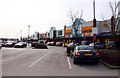
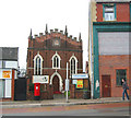
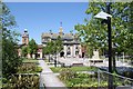
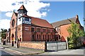
Living in CW1 2NQ offers access to essential amenities within practical reach. Retail options include Asda Crewe, Morrisons Daily Crewe Ridgeway Street, and Farmfoods Crewe, providing grocery and daily needs. The area’s rail links to Crewe, Sandbach, and Nantwich stations enable easy travel to larger towns for leisure, dining, and services. While the postcode itself has limited retail, its connection to Crewe ensures a broader range of shops and restaurants. The surrounding landscape includes historical sites like St Michael and All Angels Church and Crewe Hall, a grade-I-listed mansion. These cultural and natural features contribute to a lifestyle blending rural tranquillity with urban accessibility. The presence of industrial estates also hints at a mix of residential and commercial activity, though the focus remains on housing and community living.
Amenities
Schools
The nearest school to CW1 2NQ is Brierley Primary School, a primary institution with a good Ofsted rating. This school serves the local community, offering education for younger children in the area. The absence of secondary schools within the postcode means families may need to consider nearby towns like Crewe or Nantwich for secondary education. The presence of a primary school with a positive rating suggests a commitment to local education, though the limited range of schools reflects the area’s small size. Families prioritising primary education may find Brierley Primary sufficient, but those requiring secondary schooling should assess commuting options.
| Rank | School | Type | Entry gender | Ages |
|---|
Explore more schools in this area
Go to Schools tabDemographics
The population of CW1 2NQ is predominantly adults aged 30–64, with a median age of 47. This suggests a community of established residents, many of whom may be in their peak working years. Home ownership rates stand at 51%, indicating a mix of owner-occupied properties and rental homes. The area is characterised by houses rather than flats, reflecting a preference for single-family dwellings. The predominant ethnic group is White, though no specific data on diversity or deprivation levels is provided. The age profile implies a focus on family-oriented living, with potential for intergenerational households. The absence of detailed diversity statistics means the community’s cultural composition remains less defined, but the demographic stability suggests a low turnover of residents.
Household Size
Accommodation Type
Tenure
Ethnic Group
Religion
Household Composition
Age
Household Deprivation
NS-SEC
Explore more demographic insights in this area
Go to Demographics tabPlanning
Planning Constraints
- Flood RiskPremium
- Ramsar Wetland SitesPremium
- Area of Outstanding Natural BeautyPremium
- Protected Nature ReservePremium
- Protected WoodlandPremium