Area Overview for CW1 1YT
Photos of CW1 1YT

Area Information
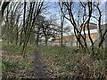
CW1 1YT is a small, densely populated postcode area in Cheshire East, England, encompassing the village of Crewe Green and surrounding clusters of homes, farms, and industrial estates. With 1,426 residents spread across 944 people per square kilometre, it reflects a compact, residential community near Crewe town centre. The area’s history is rooted in its medieval origins as a township linked to the de Crewe family, later evolving into a civil parish before being merged into Weston and Crewe Green in 2023. Today, it balances rural elements like Slaughter Hill farms with modern infrastructure, including Crewe Hall Enterprise Park. The village itself retains architectural heritage, such as the grade-I-listed Crewe Hall and its surrounding parkland. Living here means proximity to Crewe’s amenities while retaining a quieter, semi-rural character. The mix of housing, industry, and green spaces creates a distinct identity, appealing to those seeking a blend of convenience and tranquility.
- Area Type
- Postcode
- Area Size
- Not available
- Population
- 1426
- Population Density
- 944 people/km²
The property market in CW1 1YT is dominated by owner-occupied homes, with 87% of residences owned outright. This high home ownership rate contrasts with areas reliant on rental markets, suggesting a community of long-term residents rather than transient tenants. The accommodation type is predominantly houses, which aligns with the area’s semi-rural character and historical development. Given the postcode’s small size and limited expansion, property availability is constrained, making it a niche market for buyers seeking traditional homes. The presence of industrial estates like Crewe Hall Enterprise Park may influence local property values, though the primary housing stock remains residential. For buyers, this means a focus on existing homes rather than new builds, with potential for stability but limited choice. The area’s proximity to Crewe town centre may also offer access to broader property options beyond the immediate postcode.
House Prices in CW1 1YT
No properties found in this postcode.
Energy Efficiency in CW1 1YT
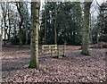
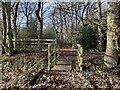
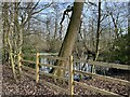
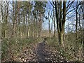
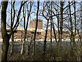
The lifestyle in CW1 1YT is shaped by its mix of retail, transport, and green spaces. Nearby amenities include supermarkets such as Co-op Gateway, Aldi University, and Tesco Crewe, providing everyday shopping convenience. The area’s rail network connects residents to Crewe, Sandbach, and Nantwich stations, facilitating access to larger towns and services. For leisure, the Crewe and Nantwich Circular Walk offers a route through local landscapes, complemented by the grade-II-listed parkland of Crewe Hall. The village itself retains historic charm, with St Michael and All Angels Church and the Jacobean mansion of Crewe Hall adding character. This blend of practical retail, transport links, and natural spaces creates a balanced lifestyle, appealing to those seeking both convenience and a connection to the countryside.
Amenities
Schools
The schools nearest to CW1 1YT include Springfield School and Safe Opportunities, both designated as special schools. These institutions cater to students with specific educational needs, reflecting the area’s focus on inclusive education. While no Ofsted ratings are provided, the presence of two special schools indicates a commitment to supporting diverse learning requirements. For families, this means access to tailored educational resources, though parents may need to consider travel times to other school types if required. The absence of mainstream schools in the immediate vicinity suggests that families may need to look beyond the postcode for primary or secondary education. This dynamic is important for buyers prioritising school proximity, as the area’s educational landscape is distinct from more conventional town centres.
| Rank | School | Type | Entry gender | Ages |
|---|
Explore more schools in this area
Go to Schools tabDemographics
The population of CW1 1YT has a median age of 47, with the majority of residents aged 30–64 years. This suggests a community skewed towards middle-aged adults, likely including families and professionals. Home ownership is high at 87%, indicating a stable, long-term resident base. The area is predominantly composed of houses rather than flats, reflecting a traditional, family-oriented housing stock. The predominant ethnic group is White, though no specific data on diversity or deprivation levels is provided. The age profile and ownership rates imply a mature, settled population with limited turnover. For buyers, this demographic suggests a focus on established homes rather than rental properties, though the small size of the area may limit housing diversity. The absence of specific data on deprivation means broader quality-of-life implications remain unquantified.
Household Size
Accommodation Type
Tenure
Ethnic Group
Religion
Household Composition
Age
Household Deprivation
NS-SEC
Explore more demographic insights in this area
Go to Demographics tabPlanning
Planning Constraints
- Flood RiskPremium
- Ramsar Wetland SitesPremium
- Area of Outstanding Natural BeautyPremium
- Protected Nature ReservePremium
- Protected WoodlandPremium