Area Overview for CW1 1NZ
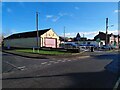
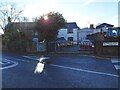
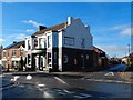
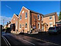
Photos of CW1 1NZ


Area Information
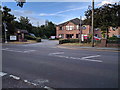
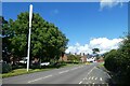
CW1 1NZ is a small residential postcode area nestled in Cheshire East, approximately 2.5 miles north-east of Crewe. With a population of 1,503, it reflects the suburban expansion of Haslington, a village historically rooted in rural tradition but now characterised by modest growth. The area’s proximity to Crewe, a key transport hub, and its access to the M6 motorway and A534 road make it a strategic location for commuters. Haslington itself, first mentioned in 1256, retains historical echoes, including Haslington Hall, a 16th-century timber-framed manor. Daily life here balances quiet village charm with modern connectivity. Residents benefit from nearby railway stations, including Crewe, which offers frequent services to London and Manchester, and a network of local shops. The area’s compact size means amenities are within practical reach, while its low crime risk and absence of environmental constraints suggest a stable, low-stress living environment. For buyers seeking a blend of historical character and contemporary convenience, CW1 1NZ presents a focused opportunity in a well-connected, family-friendly setting.
- Area Type
- Postcode
- Area Size
- Not available
- Population
- 1503
- Population Density
- 3485 people/km²
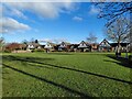
The property market in CW1 1NZ is dominated by owner-occupied homes, with 89% of properties owned by residents rather than rented. The area’s accommodation is primarily houses, which is typical of smaller, rural postcode areas. This suggests a market focused on family homes and long-term residency rather than short-term rental opportunities. The high home ownership rate indicates a stable demand for property, potentially driven by the area’s proximity to Crewe and its transport links. However, the small size of the postcode means the housing stock is limited, and buyers may need to consider nearby areas for more options. The prevalence of houses also implies a preference for private, spacious living over apartments or terraced housing. For those seeking a home in CW1 1NZ, the market is likely to be competitive, with properties holding value due to their rarity and the area’s low environmental risks.
House Prices in CW1 1NZ
No properties found in this postcode.
Energy Efficiency in CW1 1NZ
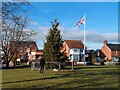
Living in CW1 1NZ offers a mix of local amenities and regional connectivity. Within practical reach are five retail venues, including Aldi University, Co-op Haslington, and Co-op Gateway, providing essential shopping and daily necessities. The area’s proximity to Crewe and its railway stations ensures access to larger towns for dining, entertainment, and cultural activities. While the postcode itself is small, its integration with Haslington’s historical character and nearby suburban growth creates a convenient balance between rural tranquillity and urban accessibility. Parks and green spaces are not explicitly detailed, but the absence of planning constraints like AONB or protected woodlands suggests open land may be available for leisure. The community’s low crime risk and mature demographic contribute to a safe, stable environment. Overall, residents benefit from a lifestyle that combines local convenience with the broader opportunities of nearby towns and transport networks.
Amenities
Schools
| Rank | School | Type | Entry gender | Ages |
|---|
Explore more schools in this area
Go to Schools tabDemographics
The population of CW1 1NZ is 1,503, with a median age of 47 and the majority of residents aged 30–64. This suggests a mature, established community with a strong presence of working-age adults. Home ownership is exceptionally high at 89%, indicating a stable, long-term resident base. The area is predominantly composed of houses, reflecting a traditional residential pattern rather than high-density housing. The predominant ethnic group is White, though no specific data on diversity or deprivation is provided. The age profile aligns with a community that may prioritise family living and long-term investment in property. With no mention of deprivation levels, the area appears to support a quality of life consistent with its low crime risk and minimal environmental constraints. This demographic profile suggests a neighbourhood where homeownership is valued, and the population is likely to be relatively cohesive and settled.
Household Size
Accommodation Type
Tenure
Ethnic Group
Religion
Household Composition
Age
Household Deprivation
NS-SEC
Explore more demographic insights in this area
Go to Demographics tabPlanning
Planning Constraints
- Flood RiskPremium
- Ramsar Wetland SitesPremium
- Area of Outstanding Natural BeautyPremium
- Protected Nature ReservePremium
- Protected WoodlandPremium