Area Overview for CW1 1AQ
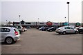
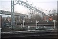
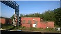
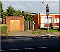
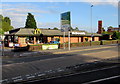
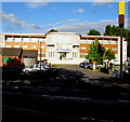
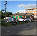
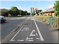
Photos of CW1 1AQ


Area Information
CW1 1AQ is a small residential postcode area in Cheshire, England, encompassing the village of Crewe Green. With a population of 1,516 and a high density of 1,072 people per square kilometre, this area is compact yet rich in historical and natural features. Formerly a civil parish, it is now part of the parish of Weston and Crewe Green, situated 1.5 miles east of Crewe town centre. The area blends rural charm with proximity to urban amenities, featuring dispersed housing, farms, and industrial estates like Crewe Hall Enterprise Park. Notable landmarks include the grade-I-listed Crewe Hall, a historic Jacobean mansion now used as a hotel, and 201 hectares of grade-II-listed parkland. Daily life here is shaped by its small-community feel, with easy access to Crewe’s services and the surrounding countryside. The area’s mix of residential and light industrial use offers a unique balance for those seeking both tranquillity and connectivity.
- Area Type
- Postcode
- Area Size
- Not available
- Population
- 1516
- Population Density
- 1072 people/km²
The property market in CW1 1AQ is characterised by a high rate of home ownership (69%) and a predominance of houses. This suggests a market skewed towards owner-occupied properties rather than rentals, likely due to the area’s residential focus and historical development patterns. The presence of both traditional homes and industrial estates like Crewe Hall Enterprise Park indicates a mix of housing types, though the data does not specify the proportion of newer builds or flats. For buyers, this means a limited inventory of properties, particularly in a small postcode area, which may drive competition. The emphasis on houses also implies that the area is less suited to those seeking high-density living or rental opportunities.
House Prices in CW1 1AQ
No properties found in this postcode.
Energy Efficiency in CW1 1AQ
The lifestyle in CW1 1AQ is shaped by its proximity to retail hubs and transport links. Nearby amenities include supermarkets such as Tesco Crewe, Morrisons Daily, and Iceland Crewe, ensuring everyday shopping needs are met. The area’s rail stations, including Crewe and Nantwich, provide access to broader networks, enhancing connectivity for commuters. For leisure, the surrounding countryside offers walking trails like the Crewe and Nantwich Circular Walk, while historical sites such as Crewe Hall and its parkland provide cultural and recreational opportunities. The mix of retail, transport, and green spaces contributes to a practical, community-oriented lifestyle, blending local convenience with regional access.
Amenities
Schools
The schools nearest to CW1 1AQ include Hungerford Primary School and two instances of Hungerford Primary Academy, both of primary type. One of the academies has an Ofsted rating of satisfactory, while the others do not have a rating listed. This mix of primary schools provides families with multiple options for early education, though the lack of detailed performance metrics means it is difficult to assess the quality of schooling comprehensively. The presence of two primary schools within the area suggests a focus on local education, which is typical for smaller communities. Families with young children may benefit from the proximity of these schools, though the absence of secondary schools necessitates travel to nearby towns like Crewe.
| Rank | School | Type | Entry gender | Ages |
|---|
Explore more schools in this area
Go to Schools tabDemographics
The population of CW1 1AQ is predominantly adults aged 30–64, with a median age of 47. This suggests a mature, stable community with a strong presence of middle-aged residents. Home ownership is high, at 69%, indicating a preference for long-term residency over rental properties. The accommodation type is primarily houses, which aligns with the area’s low-density, residential character. The predominant ethnic group is White, reflecting the broader demographic trends of the region. While specific data on deprivation is not provided, the high home ownership rate and age profile suggest a relatively stable economic environment. However, the absence of detailed diversity metrics means the full scope of community composition remains partially unexplored.
Household Size
Accommodation Type
Tenure
Ethnic Group
Religion
Household Composition
Age
Household Deprivation
NS-SEC
Explore more demographic insights in this area
Go to Demographics tabPlanning
Planning Constraints
- Flood RiskPremium
- Ramsar Wetland SitesPremium
- Area of Outstanding Natural BeautyPremium
- Protected Nature ReservePremium
- Protected WoodlandPremium