Area Overview for Waterhead
Photos of Waterhead
Area Information
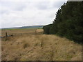
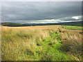
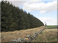
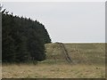
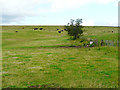
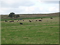
Living in Waterhead offers a life defined by deep rural isolation and historical significance. This civil parish sits within the Cumberland district of Cumbria, North West England, situated near the Scottish border with the River Irthing flowing along its eastern and southern edges. You cover an area of 18.4 square kilometres, a space dominated by pastoral landscapes and archaeological landmarks rather than urban density. The location spans coordinates approximately 54.97602, -2.659261, placing it within the Eskdale ward of Lanercost parish. A section of Hadrian's Wall runs through the parish, close to the Birdoswald Roman fort and the Hadrian's Wall Path. You might also find yourself at the site of Gilsland Spa, now home to the Gilsland Hall Hotel, which sits beside the 12th-century chapel at Tryermaine. Daily life revolves around the quiet rhythms of the countryside, anchored by the Church of St Mary Magdalene, built between 1852 and 1854. Transport relies heavily on the B6318 road connecting Langholm and Gilsland, offering limited public transit options outside this artery. The economy historically depended on farming and the tourism drawn by the spa and Roman history, though 20th-century afforestation has altered the landscape. Buying a home here means securing a property in a setting where the past remains visible in the ancient walls and historic buildings. You are entering a community that values heritage and natural beauty over modern convenience.
- Area Type
- Parish
- Area Size
- 18.4 km²
- Population
- Not available
- Population Density
- Not available
Demographics
The community in Waterhead is distinctly elderly and established. The demographic profile shows a median age of 70 years, indicating that the population is significantly older than the national average. This age distribution suggests the area is primarily retired or semi-retired, rather than a hub for young professionals or families with school-aged children. Home ownership stands at 80 per cent of households, reflecting a strong commitment to local roots and stability. The remaining 20 per cent likely comprises local tenants or less permanent residents, though specific breakdowns of smaller tenures are not detailed in the available figures. The area has seen significant population fluctuations in its history. Census data recorded 234 people in 1801, rising to a peak of 637 in 1921 when a convalescent home operated at Gilsland Spa. The numbers subsequently fell to 124 by 2001. Despite this historical decline, the parish maintains a stable identity centred on Gilsland village. The high ownership rate and older median age paint a picture of a low-turnover community where long-term residents dominate the social fabric. You will find fewer transient populations here, which often means a slower pace of life and tighter community bonds. The diversity of household composition and accommodation types remains general in the current statistics, but the dominance of older home owners shapes the local character. Quality of life here is driven by proximity to nature and a sense of belonging to an ancient village landscape.
Household Size
Accommodation Type
Tenure
Ethnic Group
Religion
Household Composition
Age
Household Deprivation
NS-SEC
Explore more demographic insights in this area
Go to Demographics tabPlanning
Planning Constraints
- Flood RiskPremium
- Ramsar Wetland SitesPremium
- Area of Outstanding Natural BeautyPremium
- Protected Nature ReservePremium
- Protected WoodlandPremium