Area Overview for Crosscanonby
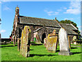
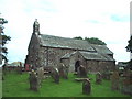
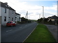
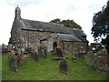
Photos of Crosscanonby
Area Information
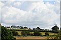
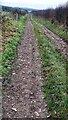
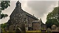
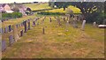
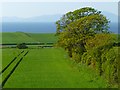
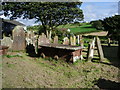
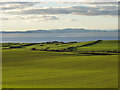
Crosscanonby is a civil parish situated in Allerdale, Cumberland, in the North West of England. The parish covers an area of 11.2 km² and lies on the Cumbrian coast, approximately 17 miles south of Whitehaven. You are exploring homes in this locality because it offers a distinct coastal setting with deep historical roots. The name derives from its historical function as an outpost for canons of Carlisle Cathedral. The civil parish is part of the recently re-established unitary authority of Cumberland, as of 2023. The town is not a single contiguous settlement but comprises five specific townships: Birkby, Crosby, Crosscanonby, Netherhall, and Maryport. The township of Maryport was formed in 1928 by being separated from Netherhall. You live in a rural coastal environment where the economy has historically relied on agriculture, fishing, and mineral extraction. Coal mining began in the late 17th century and expanded substantially throughout the 19th century, with major operations occurring at Birkby and Crosby. Birkby Colliery eventually closed in 1950. This history shapes the character of Crosscanonby today. Daily life here reflects a small-scale rural and mixed economic activity, with a population that has stabilised at approximately 1,000 inhabitants. If you are considering living in Crosscanonby, expect a quieter existence defined by its coastal position and industrial heritage.
- Area Type
- Parish
- Area Size
- 11.2 km²
- Population
- Not available
- Population Density
- Not available
Demographics
The community in Crosscanonby reflects an older population profile with a median age of 70. This figure indicates that the village is dominated by retired residents or long-term locals rather than young professionals or families. The most common age range recorded is simply listed as 'Age: Total' in the available records, suggesting a broad spread across the older demographics. Household composition and accommodation type data are categorised as 'total' in the provided information, meaning specific breakdowns of family units or building structures are not available to describe in detail. However, you can observe a very high rate of home ownership, with 75% of households owning their properties outright or with a mortgage. This high level of equity suggests stability within the community and limits the availability of rental stock for newcomers. Crime risk assessment places the area in a 'Pass' category with a safety score of 89 out of 100. This indicates low crime rates compared to the average neighbourhood. You can expect a safer environment, which often appeals to those seeking retirement locations or quiet coastal villages. The predominant ethnic group, religious makeup, and specific household composition details are not itemised with specific percentages, but the overall demographic picture is one of an established, older, owner-occupied coastal community.
Household Size
Accommodation Type
Tenure
Ethnic Group
Religion
Household Composition
Age
Household Deprivation
NS-SEC
Explore more demographic insights in this area
Go to Demographics tabPlanning
Planning Constraints
- Flood RiskPremium
- Ramsar Wetland SitesPremium
- Area of Outstanding Natural BeautyPremium
- Protected Nature ReservePremium
- Protected WoodlandPremium
- Crime RiskPremium