Area Overview for Crook
Photos of Crook

Area Information
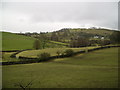
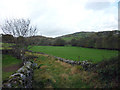
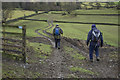
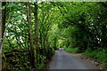
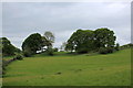
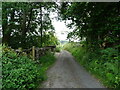
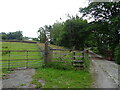
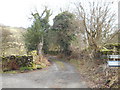
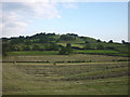
Crook stands as a distinct civil parish covering an area of 20.0 square kilometres in the North East of England. It serves as a settled community where daily life revolves around a specific local identity rather than the rapid pace of larger urban centres. The parish provides a contained environment for residents seeking a defined neighbourhood with clear boundaries. Living in Crook means accessing a rural character that is separate from the broader conurbation yet remains functional. The area's size suggests a spread of properties that allows for privacy without total isolation. This parish operates as a self-contained unit where infrastructure and local services are tailored to its specific footprint. You will find a setting that prioritizes stability over transient development. The community structure supports long-term residency patterns evident in the local housing stock.
- Area Type
- Parish
- Area Size
- 20.0 km²
- Population
- Not available
- Population Density
- Not available
Demographics
The community profile within Crook reflects a settled population with a median age of 70 years. This figure indicates that older households form the core of the residential base in this parish. A complete age breakdown is available for the total population, confirming that the demographic weight shifts heavily toward senior citizens. Sixty-eight percent, or 72% specifically, of the residents own their homes, marking this parish as a market dominated by owner-occupiers rather than private renters. The household composition data covers the full spectrum of living arrangements across the parish. Accommodation types are recorded for the total housing stock, suggesting a mix of dwellings that has evolved over several decades. The predominant ethnic group covers the total population, while religious affiliations are also recorded for the entire community. These demographics paint a picture of a mature society where stability and ownership are the primary drivers of the residential landscape.
Household Size
Accommodation Type
Tenure
Ethnic Group
Religion
Household Composition
Age
Household Deprivation
NS-SEC
Explore more demographic insights in this area
Go to Demographics tabPlanning
Planning Constraints
- Flood RiskPremium
- Ramsar Wetland SitesPremium
- Area of Outstanding Natural BeautyPremium
- Protected Nature ReservePremium
- Protected WoodlandPremium
- Crime RiskPremium