Area Overview for Clayton-le-Dale
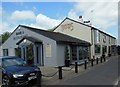
Photos of Clayton-le-Dale

Area Information
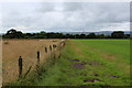
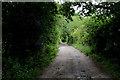
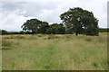
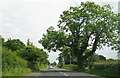
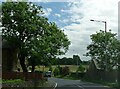
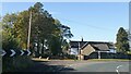
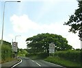
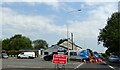
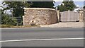
Clayton-le-Dale is a civil parish situated in the Ribble Valley district of Lancashire, North West England. This community forms part of the ancient manor of Salesbury and covers an area of 6.4 square kilometres. You will find the village positioned on the A59 road, approximately five miles south-west of Blackburn with Davyhulme. The area maintains a strong historical link to the local woodworking industry, with artisans working ash and hornbeam from the seventeenth century onwards. This heritage is visible in notable features such as St Leonard's Church, a Grade II listed building dating from the twelfth century, and Clayton Hall, a sixteenth-century Grade II listed building now used as a community centre. With a population of approximately 1,141 residents, the locality retains the character of a traditional village while offering modern conveniences. Living in Clayton-le-Dale means accessing a setting defined by its position near the historic road network and its deep roots within the Salesbury manor lands. The mix of historic landmarks and rural location provides a distinct environment for those seeking a home in north-west England.
- Area Type
- Parish
- Area Size
- 6.4 km²
- Population
- Not available
- Population Density
- Not available
Demographics
The demographic profile of Clayton-le-Dale reflects a stable, settled community with significant maturity. The median age stands at seventy years, indicating a population skewed towards older adults rather than young families or tenants. Most Common Age Range data confirms that the total population falls within broad age clusters typical of rural parishes with long-term residents. Home ownership rights in the parish are robust, with eighty-five per cent of households occupying their own residential properties. This high rate of ownership distinguishes the area from many urban centres or student-heavy locations where rental markets dominate. Accommodation Type records show a total count of dwellings without a predominance for specific tenures other than the noted ownership figure. Ethnically, the predominant group comprises those of White British heritage, which aligns with the historical continuity of the Salesbury area. Religious affiliation records exist but do not indicate a single overwhelming denomination in the provided total dataset. Understanding these figures helps you assess whether this environment suits your lifestyle expectations, particularly if you are drawn to quieter, owner-occupied neighbourhoods.
Household Size
Accommodation Type
Tenure
Ethnic Group
Religion
Household Composition
Age
Household Deprivation
NS-SEC
Explore more demographic insights in this area
Go to Demographics tabPlanning
Planning Constraints
- Flood RiskPremium
- Ramsar Wetland SitesPremium
- Area of Outstanding Natural BeautyPremium
- Protected Nature ReservePremium
- Protected WoodlandPremium
- Crime RiskPremium