Area Overview for Claughton
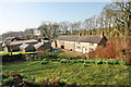
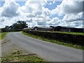
Photos of Claughton


Area Information
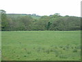
Claughton functions as a distinct locality within the Liverpool borough, occupying a compact territory of 15.3 square kilometres. The area defines itself by a strong sense of permanence and established resident presence. You will find that the community leans heavily towards long-term stability rather than transient living arrangements. Nearly seventy per cent of households in Claughton own their property, which indicates a settled population deeply rooted in the neighbourhood. This high level of ownership suggests that the area attracts buyers who intend to stay for the foreseeable future, creating a stable environment for those considering homes in Claughton. The locality balances residential needs with its geographical constraints, ensuring that daily life remains practical and manageable. Residents here enjoy a quiet setting that prioritises domestic comfort over urban novelty. While the area serves as a local hub, it operates on a scale that keeps essential services within a reasonable walking or driving distance. Living in Claughton means embracing a lifestyle characterised by ownership and continuity, where the community structure is built on a foundation of shared tenure and established routines.
- Area Type
- District Borough Unitary Ward
- Area Size
- 15.3 km²
- Population
- Not available
- Population Density
- Not available
Demographics
The community profile of Claughton reflects a mature and settled population. The median age sits at seventy years, indicating that adults and older residents form the core of the neighbourhood. This age distribution shapes the character of the area, influencing which types of amenities see the most frequent use. Home ownership stands at seventy per cent, a figure that dominates the household landscape. You will encounter a demographic where residents are likely to have built their lives in the area for several decades. The household composition data confirms that the total population is structured around these established families and individual owners. There is a clear distinction between temporary rentals and permanent residences when examining the breakdown of accommodation types in Claughton. The predominant ethnic groups and religious affiliations are present throughout the local population, contributing to the social fabric without defining the area through any single narrow lens. Deprivation indices do not feature prominently in the local context, suggesting a generally stable socio-economic environment for residents. When choosing homes in Claughton, you are entering a market where the residents value stability and tenure above rapid turnover or speculative investment.
Household Size
Accommodation Type
Tenure
Ethnic Group
Religion
Household Composition
Age
Household Deprivation
NS-SEC
Explore more demographic insights in this area
Go to Demographics tabPlanning
Planning Constraints
- Flood RiskPremium
- Ramsar Wetland SitesPremium
- Area of Outstanding Natural BeautyPremium
- Protected Nature ReservePremium
- Protected WoodlandPremium