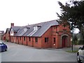
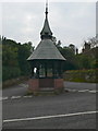
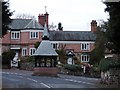
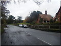
Area Overview for Christleton & Huntington Ward
Photos of Christleton & Huntington Ward
Area Information
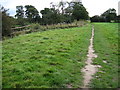
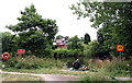
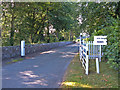
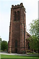
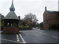
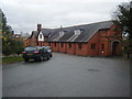
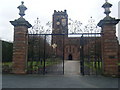
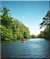
Living in Christleton & Huntington Ward offers a specific type of lifestyle situated on the southern outskirts of Chester. This ward is a district borough unitary area covering 54.6 km² of land in North West England. You will find it encompasses a collection of parishes including Christleton, Huntington, Littleton, Rowton, Waverton, Eaton, Eccleston, Poulton, and Pulford. The total population stands at 11,103 people, which creates a density of 200.2 residents per km². This distribution suggests a suburban feel rather than a dense urban experience. The location at approximately 53.157°N, 2.879°W places you at a reasonable distance from the city centre while maintaining access to local village centres. Residents enjoy a lower density environment compared to the city itself, providing more space between properties. The ward combines historical parishes with modern infrastructure needs. You are accessing a neighbourhood defined by its specific administrative boundaries within Cheshire West and Chester. This setup supports a community where local identity remains strong despite proximity to a larger city. The manageable population size helps maintain a sense of locality without the overwhelming scale of major urban centres.
- Area Type
- District Borough Unitary Ward
- Area Size
- 54.6 km²
- Population
- Not available
- Population Density
- Not available
Demographics
The community profile of Christleton & Huntington Ward indicates a settled population with distinct characteristics. The median age is 70 years old, suggesting a significant presence of older residents within the ward. This high median age reflects the nature of the housing stock and the life stage of many current homeowners. Every survey entry records the most common age range simply as "Age: Total," indicating the data aggregates across all demographic groups rather than isolating younger cohorts. Home ownership is a dominant feature here with 80% of residents owning their properties. This high rate of ownership points toward families who have stayed in their homes for extended periods or retirees who have consolidated their assets. You will not find a large renter market dominating this area. Accommodation types, ethnicity data, and religion statistics are recorded as totals, meaning these factors do not show specific breakdowns in the current dataset. The lack of detailed diversity metrics means you cannot make specific claims about ethnic composition or religious adherence from this information. The demographic picture relies heavily on the age and ownership data provided. This profile fits a leafy suburb where long-term residents prefer stability over frequent moves. The court age contributes to a quieter atmosphere in many parts of Christleton & Huntington Ward.
Household Size
Accommodation Type
Tenure
Ethnic Group
Religion
Household Composition
Age
Household Deprivation
NS-SEC
Explore more demographic insights in this area
Go to Demographics tabPlanning
Planning Constraints
- Flood RiskPremium
- Ramsar Wetland SitesPremium
- Area of Outstanding Natural BeautyPremium
- Protected Nature ReservePremium
- Protected WoodlandPremium
- Crime RiskPremium