Area Overview for Chorlton Park Ward
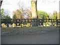
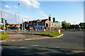
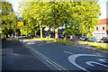
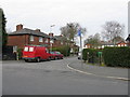
Photos of Chorlton Park Ward

Area Information
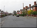
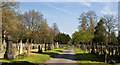
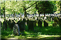
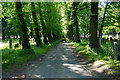
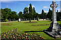
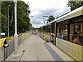
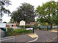
Living in Chorlton Park Ward offers a distinct residential experience within the City of Manchester. This electoral ward covers an area of just 5.0 km², yet it homes a population of 3,301 people. The location sits within the broader Chorlton-cum-Hardy district, bordering established communities like Stretford, Sale, Didsbury, and Withington. Historically, this was part of Withington Urban District before the County Borough of Manchester absorbed it in 1904. Today, the centre of the ward is defined by the presence of Chorlton Park, a public space established in 1928 on land previously used for horse racing. Daily life here is shaped by its compact size and proximity to key transport links. The former Chorlton railway station site now hosts the Chorlton Manchester Metrolink tram stop, providing direct services to East Didsbury and Manchester Airport. Residents enjoy access to historic sites such as Brookfield House and an observatory, reflecting the area's deep roots in the North West region. With a population density of 657 people per square kilometre, the ward maintains a close-knit character while benefiting from infrastructure built for a larger urban context. This mix of history and modern connectivity defines the essence of life in Chorlton Park.
- Area Type
- District Borough Unitary Ward
- Area Size
- 5.0 km²
- Population
- 3301
- Population Density
- 657 people/km²
Demographics
The community profile of Chorlton Park Ward reflects a settled, mature population. The median age for residents is 70 years, indicating that the ward comprises largely older adults. This demographic shape contrasts with many other districts around Manchester, which often attract younger families or students. House ownership stands at 51%, meaning slightly more than half of the households own their homes outright or with a mortgage. The remaining portion of households either rents or holds other forms of accommodation arrangements. Specific data on household composition, predominant ethnic groups, and religious affiliation is not provided in the current records. However, the age statistic alone suggests a community where residents may value proximity to amenities and quieter streets over nightlife or playground proximity. The population of 3,301 spread across 5.0 km² creates living density levels that feel residential rather than densely packed. Prospective buyers should note that the demographic skew toward a median age of 70 means schools and youth-focused facilities might be less central to daily life here than they are in family-heavy neighbourhoods. This demographic reality is a concrete fact of the area's social fabric.
Household Size
Accommodation Type
Tenure
Ethnic Group
Religion
Household Composition
Age
Household Deprivation
NS-SEC
Explore more demographic insights in this area
Go to Demographics tabPlanning
Planning Constraints
- Flood RiskPremium
- Ramsar Wetland SitesPremium
- Area of Outstanding Natural BeautyPremium
- Protected Nature ReservePremium
- Protected WoodlandPremium
- Crime RiskPremium