Area Overview for Appleton
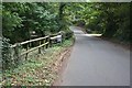
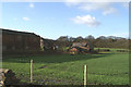
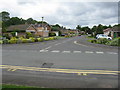
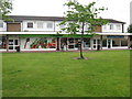
Photos of Appleton

Area Information
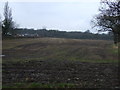
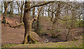
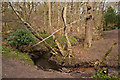
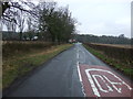
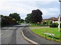
Living in Appleton offers a quiet reality far removed from the noise of major cities. This district within Warrington covers 13.3 km², providing a compact space for community life. A median age of 70 defines the demographic heart of this ward, suggesting a mature population that values stability over rapid change. You are looking at an area where daily life moves at a predictable pace, driven by established residents rather than transient commuters. The housing has changed hands over decades, resulting in a settled environment where neighbours know each other well. There are no elaborate planning constraints disrupting new development, such as Ramsar wetland sites or Areas of Outstanding Natural Beauty. You will find that residential planning is generally straightforward here, barring the presence of protected woodland. The low flood risk score of 0.28 indicates that councils do not need to maintain complex drainage systems to mitigate water issues. Crime statistics reflect a calm neighbourhood with a safety score of 87 out of 100. When you settle into homes in Appleton, you join a community defined by age and permanence rather than transient energy. The area functions as a reliable base for retirement or quiet living rather than a hub for startup culture. Your mornings likely begin in a spacious home overlooking a garden or a park rather than a traffic jam. The visual landscape remains largely green and uncluttered by industrial sprawl.
- Area Type
- Parish
- Area Size
- 13.3 km²
- Population
- Not available
- Population Density
- Not available
Demographics
The community in Appleton is shaped almost entirely by older residents living in their own properties. Statistical analysis reveals a home ownership rate of 94%, a figure that dictates the social fabric of the ward. You are entering a market where predicting local behaviour is easy because the tenants are also owners. This statistic means that the local council relies heavily on council tax rather than tenant rents to fund public services. The overwhelming majority of residents fall into the broadest age category, reinforcing the median age of 70. Young families and singles are rare exceptions in this demographic profile. Household composition data confirms that people here have put down roots and built long-term ties to the street. The sheer volume of ownership suggests a low turnover of residents, creating a neighbourhood where history is recorded on doorsteps rather than rental agreements. Social dynamics are stable, driven by a population that has weathered economic shifts without displacement. Local events and community groups likely consist of established volunteers rather than rotating participants. Diversity metrics are not provided in the available statistics, so the focus remains on the age and tenure of the population. The area does not exhibit the rapid demographic shifts seen in urban regeneration zones. Instead, it stands as a consistent example of traditional suburban living.
Household Size
Accommodation Type
Tenure
Ethnic Group
Religion
Household Composition
Age
Household Deprivation
NS-SEC
Explore more demographic insights in this area
Go to Demographics tabPlanning
Planning Constraints
- Flood RiskPremium
- Ramsar Wetland SitesPremium
- Area of Outstanding Natural BeautyPremium
- Protected Nature ReservePremium
- Protected WoodlandPremium