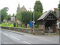
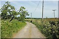
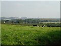
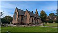
Area Overview for Kingsley
Photos of Kingsley

Area Information
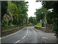
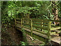
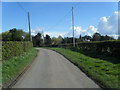
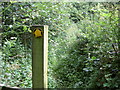
You are looking at Kingsley, a civil parish covering an area of 11.9 km² in England. This compact territory offers a defined sense of place without the sprawl of larger towns. The environment here presents a clear picture of a settled community. You will find protected woodland within the boundaries, which acts as a natural feature for residents to enjoy. There is no coverage under Ramsar Wetland Sites or the Area of Outstanding Natural Beauty, meaning planning constraints in these specific categories do not apply to your potential home search. The absence of these designations allows for a straightforward understanding of the land's classification. Daily life in Kingsley is shaped by its unique demographic profile. The area is home to residents who have likely settled down over time. You do not need to worry about high flood risks, as the coverage indicates a low threat level. Living in Kingsley means engaging with an environment where safety scores indicate below-average crime rates. The parish provides a specific setting where you can navigate between the natural presence of protected woodlands and a broader landscape free from AONB restrictions. It is a place where the physical boundaries are clear and defined.
- Area Type
- Parish
- Area Size
- 11.9 km²
- Population
- Not available
- Population Density
- Not available
Demographics
The community in Kingsley reflects a settled population with distinct characteristics over time. Data indicates a median age of 70, which tells you that residents here are significantly older than the national average. This statistic defines the social fabric of the parish. You will find that the total household composition and accommodation types align with an older demographic living structure. Nearly all residents, standing at 88%, own their homes outright. This figure of 88% ownership suggests a profound level of stability within the parish. You are unlikely to encounter a transient young professional population moving around frequently. Instead, the majority of people live in properties they have called home for decades. The most common age grouping spans the entire demographic spectrum, yet the central tendency leans heavily towards retirement age. This profile influences local services and community interactions. When you consider living in Kingsley, you are entering a neighbourhood where home ownership is the norm rather than the exception. The lack of variation in household composition further underscores the consistency of this older, owner-occupied demographic. You can expect a quiet, established community dynamic rather than a rapidly shifting population.
Household Size
Accommodation Type
Tenure
Ethnic Group
Religion
Household Composition
Age
Household Deprivation
NS-SEC
Explore more demographic insights in this area
Go to Demographics tabPlanning
Planning Constraints
- Flood RiskPremium
- Ramsar Wetland SitesPremium
- Area of Outstanding Natural BeautyPremium
- Protected Nature ReservePremium
- Protected WoodlandPremium