Area Overview for Great Boughton
Photos of Great Boughton

Area Information
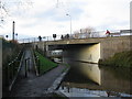
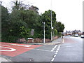
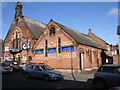
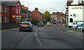
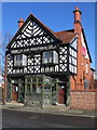
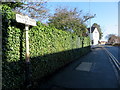
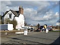
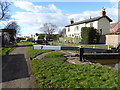
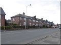
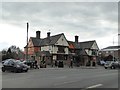
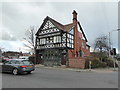
Great Boughton is a civil parish located in the unitary authority of Cheshire West and Chester. It lies approximately one mile east of Chester city centre on a bend in the River Dee. This district covers an area of 2.3 km² and incorporates the villages of Boughton Heath and Vicars Cross. The parish possesses a history stretching back into Roman times, originating from natural water springs that served the nearby Roman fortress. You will find remnants of this ancient core in Boughton Lodge and the Manor House, both dating from the seventeenth and eighteenth centuries. The area transitioned from a historical settlement to a suburban district following housing estate developments from the 1960s onwards. Most current buildings in Great Boughton stem from these post-war expansions spreading from established areas like Boughton and Vicar Cross Road. The site of the former Spital Boughton leper hospital, founded in the 12th century, remains marked by an inscription from 1935. While the area gained notoriety in the 1880s with events known as Black Sunday, today it functions as a residential community. Living in Great Boughton offers proximity to the Chester and Crewe railway line, which runs through the vicinity. The region includes St Giles Cemetery and finds its governance within the Parish Council, which was founded in 1894. You can walk along the River Dee or explore the area's Roman foundations when deciding on homes in Great Boughton.
- Area Type
- Parish
- Area Size
- 2.3 km²
- Population
- Not available
- Population Density
- Not available
Demographics
The community in Great Boughton is defined by a significant older population. The median age for residents is 70 years old, indicating a demographic heavily skewed towards retirees or elderly adults. This high age figure defines the social rhythm of the area, as most households likely consist of long-term residents rather than young families moving in. Home ownership stands at a robust 81%, which suggests a settled population with a strong sense of permanence. This ownership rate is unusual compared to many other parts of the country where rental markets are dominant. The area does not show specific data regarding household composition or predominant ethnic groups in the available statistics. This lack of detailed breakdown means you cannot assess diversity or family structures with precision using current figures. You must rely on the clear indicator that the vast majority of residents own their properties outright or with a mortgage. The absence of specific data on accommodation types beyond the ownership percentage means you cannot determine if terraced, semi-detached, or detached homes dominate the street frontages. However, the high ownership figure combined with the age profile implies a stable, established neighbourhood where residents have likely lived for decades.
Household Size
Accommodation Type
Tenure
Ethnic Group
Religion
Household Composition
Age
Household Deprivation
NS-SEC
Explore more demographic insights in this area
Go to Demographics tabPlanning
Planning Constraints
- Flood RiskPremium
- Ramsar Wetland SitesPremium
- Area of Outstanding Natural BeautyPremium
- Protected Nature ReservePremium
- Protected WoodlandPremium