Area Overview for Wistaston
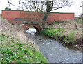
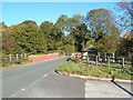
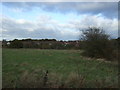
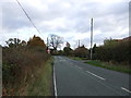
Photos of Wistaston

Area Information
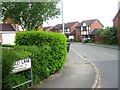
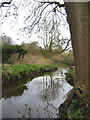
Living in Wistaston offers a quiet existence within a distinct civil parish located in the Cheshire East unitary authority. You will find this small village situated approximately 2½ miles north-east from Nantwich and just 2 miles west-south-west of Crewe railway station. The area covers a compact 5.9 km², providing a manageable space for those seeking a rural yet accessible lifestyle. Historically, the site dates back to the Domesday Survey of 1086, where it appeared as Wistanestune as a farmstead with woodland and arable land. St Mary the Virgin church stands as a central landmark, having been rebuilt between 1827 and 1828 after the original structure decayed. A Methodist Chapel from 1945, later rebuilt in 1967, also serves the local community. The population stands at 1,755 residents across this modest footprint, creating a tightly knit atmosphere rather than a bustling urban scene. You live in a setting defined by its historical roots and proximity to key transport links. The Parish forms part of the ancient Nantwich hundred, linking past and present for anyone considering homes in Wistaston. Daily life here revolves around local amenities and the convenience of nearby towns without the density of a city centre. Crewe station remains a vital connection, while the village itself retains the character of an ancient parish that successfully separated from Wybunbury around 1299 or 1300. This historical continuity shapes the identity of the community, offering a sense of permanence for long-term residents.
- Area Type
- Parish
- Area Size
- 5.9 km²
- Population
- 1755
- Population Density
- 298 people/km²
Demographics
The community in Wistaston presents a clearly defined age profile suitable for retirees or families with grown children. The median age for residents reaches 70 years, indicating a population skewed significantly towards older demographics. This high median age contrasts with many active city areas, suggesting a slower pace of life where you might encounter fewer young adults in the daily streets. The most common age range totals across the board, reflecting the broad but older distribution of the population. With 82% of households owning their homes, less than one in five residents rents their property. This high ownership rate implies financial stability among residents and a strong desire to build equity rather than seek flexible rental agreements. Accommodation types vary within the parish, though the text does not specify exact ratios between detached, semi-detached, or terraced housing. The dominant home ownership figure of 82% suggests that many properties have been held by families for generations, likely reflected in the historical manor houses noted in the area records. You will find a neighbourhood where people have invested deeply in their local environment. Ethnic and religious diversity data are currently unavailable for specific breakdown, but the community remains a localized entity. This demographic structure means that local services and social groups cater to an older demographic, potentially influencing planning decisions for future facilities. When looking at homes in Wistaston, you are entering a market dominated by settled owners rather than transient tenants.
Household Size
Accommodation Type
Tenure
Ethnic Group
Religion
Household Composition
Age
Household Deprivation
NS-SEC
Explore more demographic insights in this area
Go to Demographics tabPlanning
Planning Constraints
- Flood RiskPremium
- Ramsar Wetland SitesPremium
- Area of Outstanding Natural BeautyPremium
- Protected Nature ReservePremium
- Protected WoodlandPremium