Area Overview for Willaston (Cheshire East)
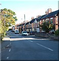
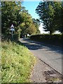
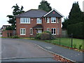
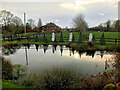
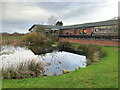
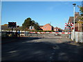
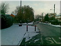
Photos of Willaston (Cheshire East)
Area Information
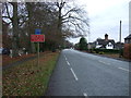
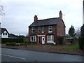
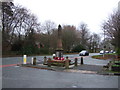
Living in Willaston (Cheshire East) defines a settlement rather than a sprawling town. This civil parish covers exactly 1.1 km² and sits approximately one and a half miles east by north of Nantwich. It lies three miles west of Crewe town centre and two miles east of the Nantwich town area. The location places you adjacent to the Crewe and Shrewsbury railway corridor, which historically served the area from 1870-72. You are currently within practical reach of Hadlow Road Station, Nantwich Railway Station, and Crewe Railway Station. The village maintains a closer link to Nantwich than to Crewe, positioning you two miles from Nantwich town. Historical records note the seat of W. Bennett, Esq., known as W. Hall. This proximity to larger centres offers a balance between village life and town amenities. You are close to notable local points of interest including The Leopard and The Globe Pub. Speciality shops such as Austin's Yesteryear Grocers Shop and Mandi Boo are also within reach. Families often access Nantwich Market, Nantwich Museum, and St Mary's Church in nearby Nantwich for wider leisure activities. This compact footprint and strategic location create a distinct residential identity for the area.
- Area Type
- Built Up Area 250
- Area Size
- 1.1 km²
- Population
- Not available
- Population Density
- Not available
Your daily life in Willaston (Cheshire East) is enriched by a selection of accessible retail and leisure venues. There are five retail outlets situated within practical reach of the area. Co-op Wistaston, Spar, and Co-op Stapeley stand out as the most notable shopping destinations. These supermarkets form the backbone of your weekly shop and provide essential goods without unnecessary travel. For socialising, the area offers The Leopard and The Globe Pub. The Barrel and Tap also operates in the vicinity, providing venues for evening leisure. You will find Austin's Yesteryear Grocers Shop and Mandi Boo nearby for speciality and gift items. These smaller shops add character to your daily routine and offer unique products not found in standard supermarkets. While Willaston itself is a small civil parish, the wider Nantwich area hosts larger attractions. You can visit Nantwich Market and Nantwich Museum for culture and shopping. St Mary's Church in Nantwich is a significant historical site accessible from Willaston. This proximity to Nantwich ensures you have access to a broad range of amenities while maintaining a village setting. Living in Willaston (Cheshire East) balances local convenience with easy access to town attractions.
Amenities
Schools
For families considering Willaston (Cheshire East), there are two primary educational institutions immediately on your doorsteps. Willaston Primary School serves as one of the main educational facilities in the locality. The second option is Willaston Primary Academy. Both institutions at this location operate at the primary level. These schools provide local education for children growing up in the village or commuting from nearby settlements. The presence of two primary options suggests a choice for families with children of school age. You do not have data regarding secondary schools or specific Ofsted ratings for these institutions in the provided information. The school mix therefore relies entirely on these primary establishments for local education needs. Living in Willaston (Cheshire East) means relying on these local primaries for early childhood education. Families must consider transport to the next phase of schooling, as secondary options are not listed for the parish itself. The availability of two primary schools indicates that young families are a recognized part of the local demographic structure, despite the higher median age elsewhere.
| Rank | School | Type | Entry gender | Ages |
|---|
Explore more schools in this area
Go to Schools tabDemographics
The community in Willaston (Cheshire East) reflects a settled population with significant stability. The median age in the area stands at 70 years. This figure indicates a demographic skewed towards older residents and families with dependent children less common here. Home ownership is the dominant living arrangement, with 85% of households owning their property. This high level of tenure suggests long-term residents deeply embedded in the local community. The area functions as a built-up area where nearly nine out of ten people reside in their own homes rather than renting. Age statistics reveal that the 'Total' age range represents the most common demographic grouping in the area. This broad categorisation encompasses the wide age spread resulting from the high median age. There is no specific data provided regarding predominant ethnic groups or religious affiliations for this location. Consequently, the demographic narrative relies heavily on the age and tenure data available. The household composition statistics reflect this total population structure. Living in Willaston (Cheshire East) means joining a neighbourhood where property ownership is the norm and the population centres on later-life demographics.