Area Overview for Crewe
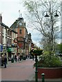
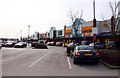
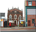
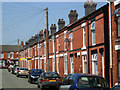
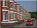
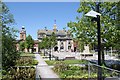
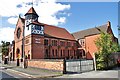
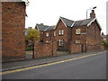
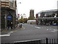
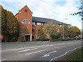
Photos of Crewe
Area Information
Crewe is a built-up area in England covering 19.2 km², home to 25,861 residents. With a population density of 1,350 people per square kilometre, it balances urban living with accessible green spaces. The town’s character is shaped by its mix of residential and commercial zones, supported by three railway stations—Crewe, Nantwich, and Sandbach—that link it to nearby towns. Daily life in Crewe revolves around its schools, retail hubs, and transport networks. The area’s median age of 70 suggests a community skewed toward older residents, which influences local services and amenities. For buyers, Crewe offers a compact, well-connected environment with a range of schools and shops within reach. Its proximity to major roads and rail lines makes it a practical choice for commuters, while the broadband score of 92 ensures reliable internet for both work and leisure.
- Area Type
- Built Up Area 250
- Area Size
- 19.2 km²
- Population
- 25861
- Population Density
- 1350 people/km²
Crewe’s lifestyle is defined by its proximity to essential amenities. Retailers such as Morrisons Daily, Morrisons Crewe, and Asda Crewe offer a range of shopping options, while three railway stations—Crewe, Nantwich, and Sandbach—provide transport links to surrounding areas. The town’s schools, including Brierley Primary and Gainsborough Junior, contribute to a family-friendly environment. Though green spaces are not detailed, the area’s compact size ensures amenities are within walking or short driving distance. This accessibility fosters a practical, community-oriented lifestyle where daily needs are met without excessive travel.
Amenities
Schools
Crewe’s schools include Westminster Nursery School, a nursery, and Crewe Secondary Unit, which serves older students. Brierley Primary School, rated ‘good’ by Ofsted, offers a solid foundation for younger children, while Broad Street Nursery and Infant School and Gainsborough Junior School provide early education options. The mix of nursery, primary, and secondary schools ensures families can access education at every stage. Brierley Primary’s ‘good’ rating highlights a standard of teaching that meets national benchmarks, though no other schools have specific ratings. The presence of multiple schools within the area supports a community focused on education, with options for both local and broader needs.
| Rank | School | Type | Entry gender | Ages |
|---|
Explore more schools in this area
Go to Schools tabDemographics
Crewe’s population has a median age of 70, the highest in the UK, indicating a community predominantly composed of older residents. Home ownership stands at 64%, suggesting a stable housing market with a strong presence of owner-occupied properties. The data does not specify household composition or accommodation types, but the high median age may reflect a demographic with long-term residency patterns. The area’s ethnic and religious diversity is not detailed, but the figures provided imply a homogenous profile. This age structure could influence local services, with healthcare and community centres playing a central role. While deprivation data is not included, the town’s amenities and transport links suggest a baseline of accessibility for residents.