Area Overview for Cherryfield Ward
Photos of Cherryfield Ward


Area Information
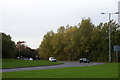
Living in Cherryfield Ward offers a settled experience within the Metropolitan Borough of Knowsley. You will find this electoral ward located approximately five degrees south of the line joining London and Edinburgh, situated near Huyton and Liverpool. The area covers a total land size of 4.0 km², providing a compact yet distinct community. Surrounding neighbourhoods such as Northwood, Shevington, and Whitefield form the immediate living environment for residents. Living in Cherryfield Ward means navigating a space that functions as a self-contained unit within the broader North West England region. The geography is defined by its boundaries rather than dramatic natural features, as protected natural areas make up zero per cent of the land cover. This transparency in planning constraints suggests that development follows standard urban rules rather than facing significant ecological restrictions. You can expect a daily life that is primarily shaped by local infrastructure and the specific mix of households found across these four square kilometres. Your view of the daily rhythm here depends heavily on which of the adjacent neighbourhoods you call home, but the ward acts as a cohesive administrative block for all residents.
- Area Type
- District Borough Unitary Ward
- Area Size
- 4.0 km²
- Population
- Not available
- Population Density
- Not available
Demographics
The community profile of Cherryfield Ward reveals a distinctly mature population. The median age in the area stands at 70 years, indicating that many residents are either approaching or have already reached retirement age. This demographic reality shapes the social dynamics and local services required within the ward. More than half of the households report ownership of their property, with a home ownership rate of 57 per cent. This figure places Cherryfield Ward in a category where long-term security remains a strong theme for most families and individuals. Despite the age concentration, the household composition data does not highlight specific ratios of single-person homes versus large families, as the dataset only confirms the total category. Similarly, while the predominant ethnic group, religious affiliations, and specific accommodation type breakdowns are not detailed in the provided figures, the age and ownership statistics remain the clearest indicators of community structure. The high median age suggests that daily life revolves around retirement activity, medical access, and established routines rather than rapid growth or transient living patterns.
Household Size
Accommodation Type
Tenure
Ethnic Group
Religion
Household Composition
Age
Household Deprivation
NS-SEC
Explore more demographic insights in this area
Go to Demographics tabPlanning
Planning Constraints
- Flood RiskPremium
- Ramsar Wetland SitesPremium
- Area of Outstanding Natural BeautyPremium
- Protected Nature ReservePremium
- Protected WoodlandPremium
- Crime RiskPremium