Area Overview for Cheadle Hulme
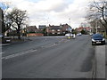
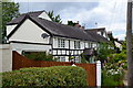
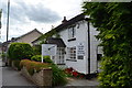
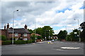
Photos of Cheadle Hulme


Area Information
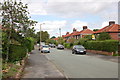
Cheadle Hulme is a compact built-up area in England, spanning 5.9 km² and home to 4,613 residents. With a population density of 776 people per square kilometre, it is a tightly knit community where daily life is shaped by proximity to local amenities and transport links. The area’s demographic profile is distinctive, with a median age of 70, suggesting a population skewed towards older adults. This influences the character of the neighbourhood, where stability and familiarity are key. Residents benefit from a mix of retail, transport, and leisure options within easy reach, including supermarkets, railway stations, and nearby airports. While the area is not expansive, its density supports a practical lifestyle, with services and connections accessible without long commutes. For those considering living in Cheadle Hulme, the blend of established infrastructure and community-centric living offers a clear appeal, though the age profile and local safety assessments should be weighed carefully.
- Area Type
- Built Up Area 250
- Area Size
- 5.9 km²
- Population
- 4613
- Population Density
- 776 people/km²
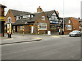
Cheadle Hulme offers a range of amenities within easy reach, including retail options such as M&S Cheadle Hulme BP, Co-op Gill, and Tesco Cheadle. These shops provide daily essentials, supporting a practical lifestyle. The area’s transport links extend beyond rail and metro, with nearby airports offering regional and national connectivity. Parks and open spaces are not explicitly named in the data, but the presence of multiple retail and transport hubs suggests a balance between urban convenience and recreational opportunities. The density of amenities means residents can access shopping, dining, and travel options without long journeys. This accessibility contributes to a lifestyle where convenience and connectivity are prioritised, though the lack of specific park names leaves room for further exploration of green spaces.
Amenities
Schools
Cheadle Hulme is served by several primary schools, including Bradshaw Hall Junior School, Bruntwood Primary School, Hursthead Infant School, Hursthead Junior School, and Orrishmere Primary School. Hursthead Infant School holds an Ofsted rating of ‘good’, offering families a notable option for early education. The presence of multiple primary schools ensures accessibility for young families, though the data does not provide ratings for other schools. The concentration of primary schools suggests the area is well-suited for households with children, though parents may need to assess individual school performance beyond the data provided. The mix of school types reflects a focus on foundational education, with no secondary schools listed, meaning families may need to look beyond the immediate area for secondary options.
| Rank | School | Type | Entry gender | Ages |
|---|
Explore more schools in this area
Go to Schools tabDemographics
The community in Cheadle Hulme is defined by its age profile, with a median age of 70, reflecting a population predominantly in older adulthood. This demographic is notable, as it contrasts with areas with younger, more diverse age ranges. Home ownership is high, with 81% of residents owning their homes, indicating a stable and long-term resident base. The data does not specify household composition or accommodation types, but the high home ownership rate suggests a community where property is often held for the long term. The area’s population density—776 people per km²—means it is neither sprawling nor sparse, fostering a sense of closeness. While no specific figures on diversity or deprivation are provided, the age profile and ownership statistics imply a mature, settled population with established routines and needs. This context is crucial for understanding the area’s character and the services that cater to its residents.
Household Size
Accommodation Type
Tenure
Ethnic Group
Religion
Household Composition
Age
Household Deprivation
NS-SEC
Explore more demographic insights in this area
Go to Demographics tabPlanning
Planning Constraints
- Crime RiskPremium