Area Overview for Charnock Ward
Photos of Charnock Ward
Area Information
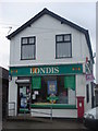
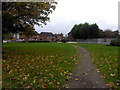
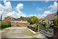
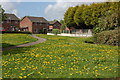
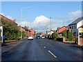
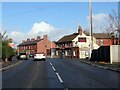
Living in Charnock Ward offers a distinctly settled experience within a very compact district. This ward covers just 1.7 km², making it one of the most densely concentrated residential areas in the wider borough. You will find a neighbourhood defined by stability rather than rapid expansion, where the pace of life remains determined by local routines. The sheer size of the area implies that daily errands and local exploration cover very short distances, which suits those who prefer a walkable environment. Residents enjoy a community where stability is the norm, supported by high rates of existing ownership. There is no rush for development here, as the land is already built out. This character makes Charnock Ward an ideal choice for individuals seeking a quiet, established setting without the noise of larger districts. The small footprint means that boundaries are close, and neighbours are likely to know one another after a short period. Families and long-term residents dominate the landscape of this ward. The demographic profile suggests an area where people have put down roots for decades. Daily life centres around immediate surroundings rather than distant commercial hubs, relying on local amenities that have served the community for generations. If you are considering homes in Charnock Ward, you are entering a space defined by its intimacy and established nature.
- Area Type
- District Borough Unitary Ward
- Area Size
- 1.7 km²
- Population
- Not available
- Population Density
- Not available
Demographics
The community profile of Charnock Ward points heavily toward a mature population. The median age in the area stands at 70, indicating that the vast majority of residents are older adults. This age structure shapes the social fabric, creating an environment where longevity and retirement living are central themes. You will not find many young professionals or families with toddlers dominating the scene in the traditional sense. Home ownership reinforces this demographic reality, with 75% of households owning their property outright or with a mortgage. This high level of equity suggests that the former residents who settle here intend to stay, further locking in the older age profile. The remaining 25% comprises rented accommodation, but even this segment largely supports an older demographic rather than a dynamic, young professional cohort. With 75% of homes owned, the financial landscape of Charnock Ward differs significantly from typical student or commuter hotspots. The household composition reflects a society where tenure stability is the priority. Residents benefit from predictable housing costs and a lack of tenant turnover. Living in Charnock Ward means you are part of a demographic where the years ahead are valued over the decades behind. This consistency provides a secure environment for those prioritising peace and quiet over career networking.
Household Size
Accommodation Type
Tenure
Ethnic Group
Religion
Household Composition
Age
Household Deprivation
NS-SEC
Explore more demographic insights in this area
Go to Demographics tabPlanning
Planning Constraints
- Flood RiskPremium
- Ramsar Wetland SitesPremium
- Area of Outstanding Natural BeautyPremium
- Protected Nature ReservePremium
- Protected WoodlandPremium
- Crime RiskPremium